Quiet Persistence
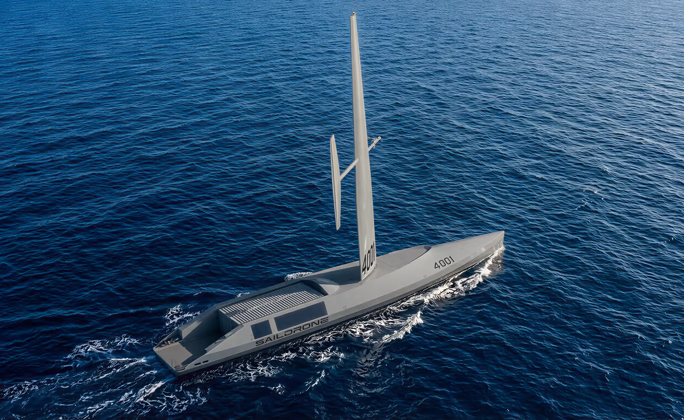
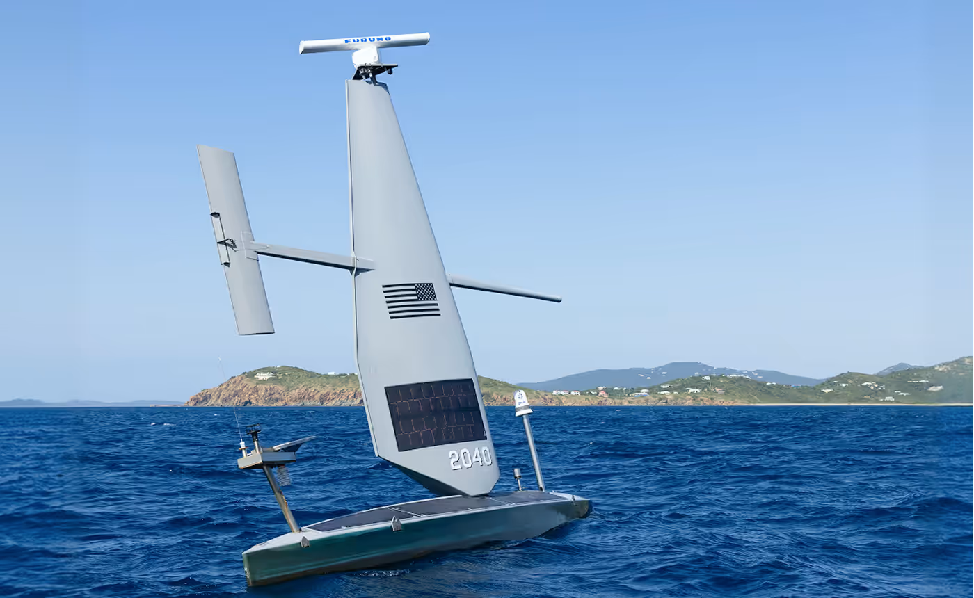
Optimized for anti-submarine warfare and ISR, with near-silent propulsion, long-range endurance, and payload capacity for towed arrays, variable-depth sonar, and other mission systems.
Equipping forces with the operational awareness and effects required to secure and control the maritime domain
Real-time surface ISR using radar, vision, AIS fusion, and AI-driven classification.
Long-range acoustic sensing and persistent subsurface awareness.
Deep-ocean and coastal mapping with high-resolution multibeam sonar.
Autonomous platforms capable of integrating mission-ready payload effects above and below the surface.
Extreme endurance. Proven autonomy. Saildrone USVs operate in the harshest environments and remain on-station and on-mission, enabling manned ships and their crews to focus on the missions that only they accomplish. Equipped with a range of payloads, Saildrone USVs deliver intelligence and mission effects with unrivaled efficiency.
Optimized for anti-submarine warfare and ISR, with near-silent propulsion, long-range endurance, and payload capacity for towed arrays, variable-depth sonar, and other mission systems.
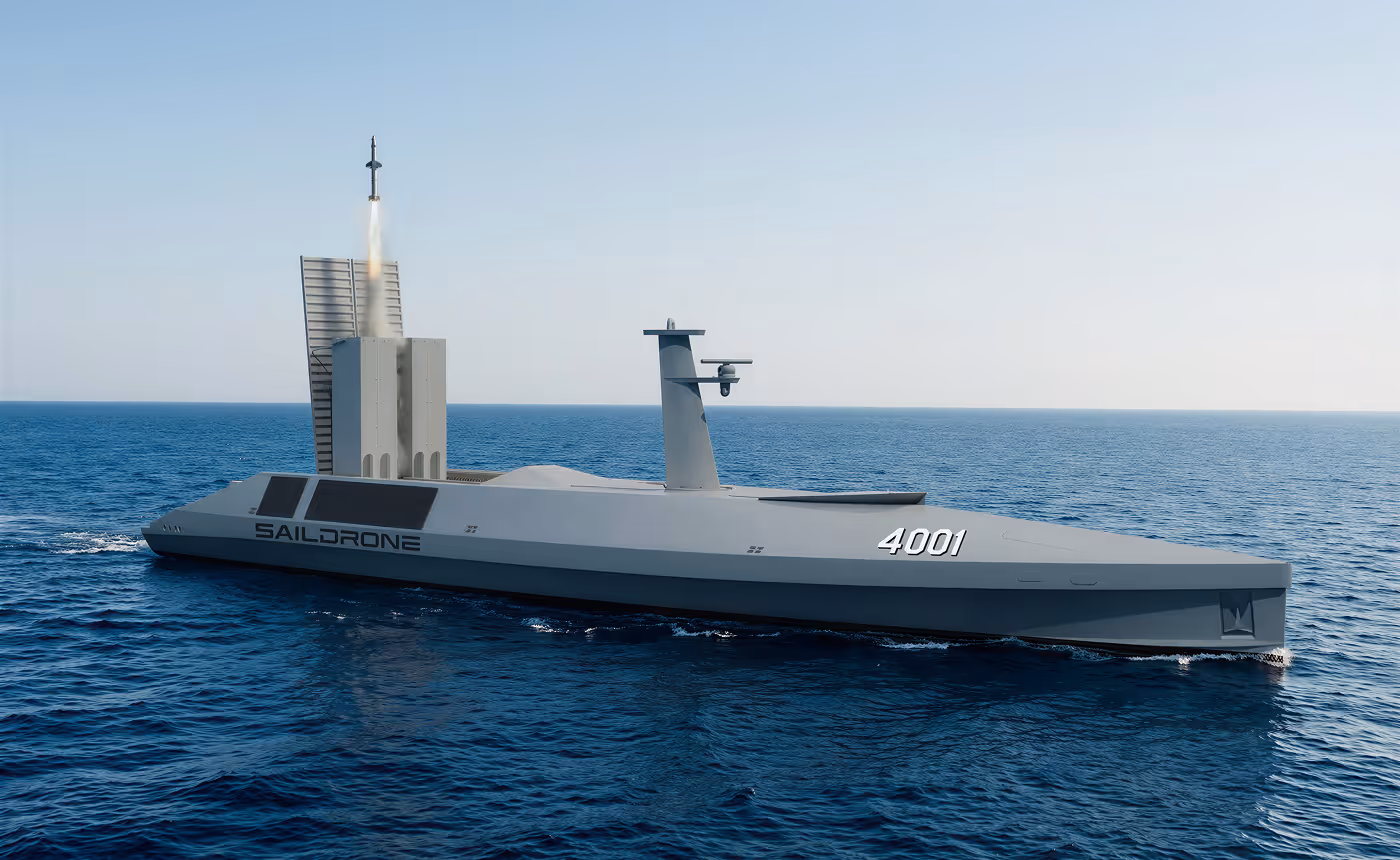
Configured without the wing for higher-speed, low-observable missions, with concealed payload capacity for modular effectors and other kinetic systems.
Engineered for deep-ocean mapping, undersea detection, and maritime power projection. Integrates advanced sensors for persistent ISR above and below the surface, and modern effectors to shape the battlespace.
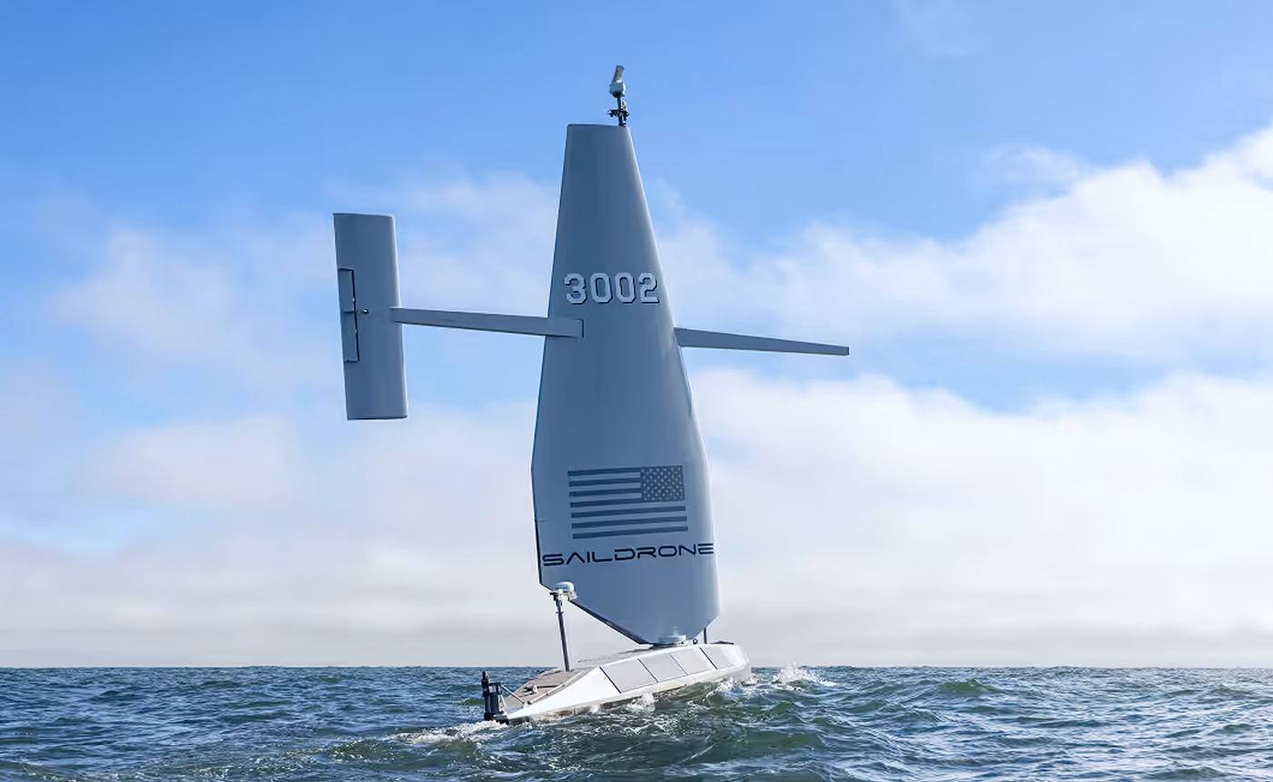
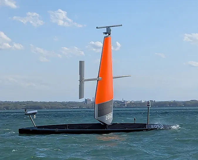
A mid-size USV for maritime domain awareness, counter-narcotics, illegal maritime immigration, electronic surveillance, and coastal mapping.
A proven, globally deployed platform designed for environmental sensing. Small footprint, extended presence.
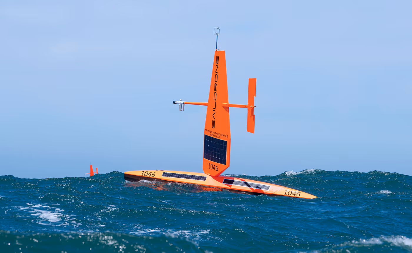

Months at sea, unmanned—powered by wind and solar for unmatched persistence in contested or remote waters.
Multi-sensor fusion, AI-driven detection, and real-time surface and subsurface awareness for commanders and operators.
Deploy unmanned assets where crewed vessels can’t—or shouldn’t—reducing cost, risk, and manpower burden while expanding mission reach.