Improving Prediction of El Niño Weather Events in the Pacific Ocean
An ongoing mission to test the Saildrone platform as part of the Tropical Pacific Observation System monitoring weather and climate in the Pacific Ocean.
The Problem
El Niño and La Niña impact weather patterns and climate on both sides of the Pacific and around the world, leading to coastal flooding, droughts, wildfires, and shifts in fish stocks. The Tropical Pacific Observation System (TPOS) was developed to monitor oceanographic and meteorological conditions in the region to improve early predictions of these major weather events. The TPOS 2020 project was initiated by the National Oceanic and Atmospheric Administration (NOAA) and 13 science organizations from six countries to redesign the system. The cost and complications of maintaining the existing network of ship-based surveys, satellites, and moored buoys prompted NOAA and its partners to look for a new tool to maintain and ultimately improve the quality of data.
Solution
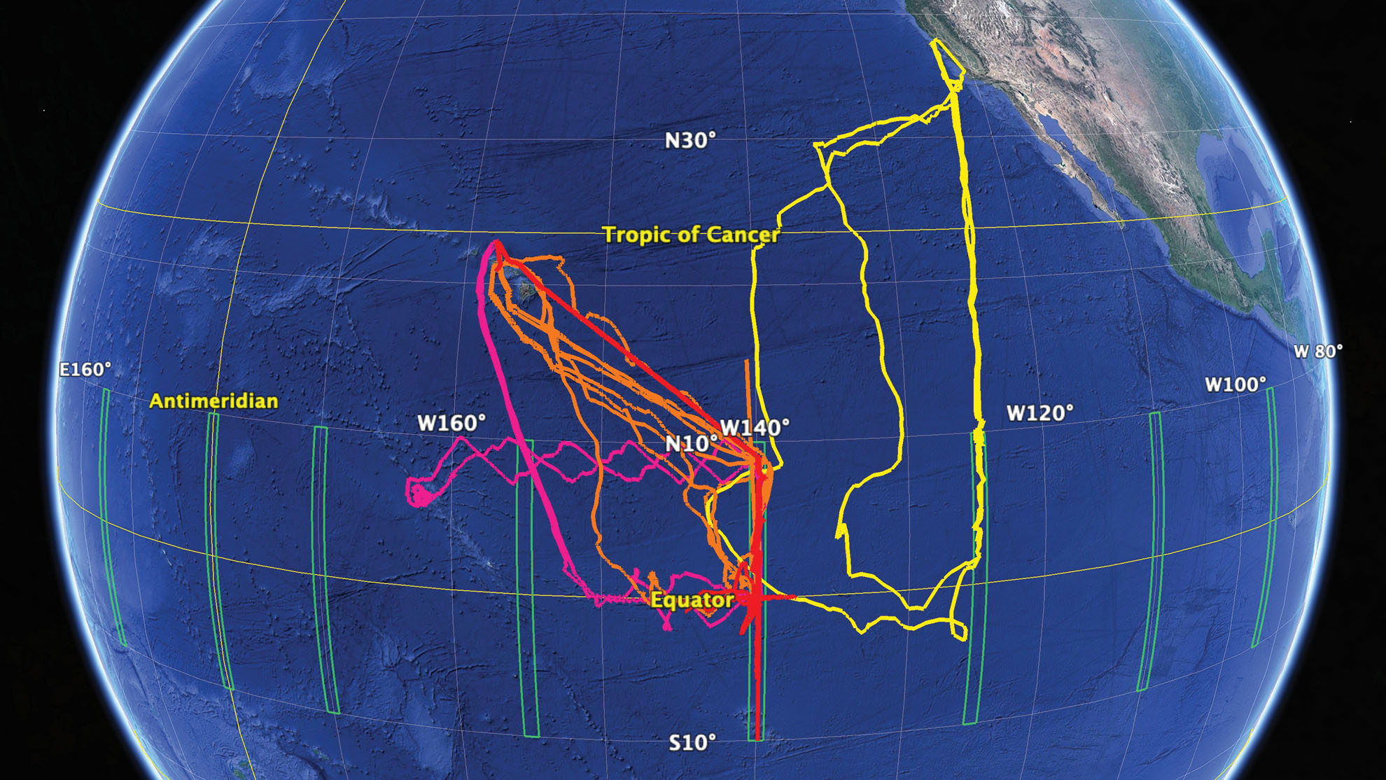
In September 2017, Saildrone partnered with NOAA to launch a series of six-month missions to the Tropical Pacific to test how unmanned surface vehicles (USVs) could augment TPOS data collection and improve long-term weather forecasting. During the first mission, two Saildrone USVs rendezvoused with the RV Roger Revelle to validate collected measurements. While in the survey area, the USVs sailed patterns around moored buoys to provide spatial and temporal gradient information as well as validate buoy sensors. Over the past several years, Saildrone USVs have been deployed from San Francisco and Hawaii to survey near the equator, and from Guam to collect surface ocean and meteorological measurements in the Kuroshio Surface Current.
Outcome
The preliminary data revealed findings regarding sea surface temperature shifts previously undetectable by satellite or buoy. This demonstrated that Saildrone USVs can successfully augment TPOS data collection to help understand environmental phenomena and develop essential global weather forecasts.
Preliminary data revealed findings regarding sea surface temperature shifts previously undetectable by satellite or buoy.
“We are surprised by how abrupt these fronts are. Some of these warm water fronts are so sharp that the ocean is changing a whole degree in temperature over less than a kilometer."


Start Your Mission Today
Contact us now to discuss your mission requirements.