Autonomous Subsurface Intelligence for Protecting Critical Infrastructure
Autonomous systems engineered to map the shallow subsurface with precision—revealing buried features, threats, and anomalies to safeguard national security interests and undersea infrastructure.
Saildrone delivers high-quality sub-bottom profiling using long-endurance uncrewed surface vehicles equipped with advanced acoustic systems. By combining autonomous navigation with continuous subsurface imaging, Saildrone exposes sediment layers, buried objects, and infrastructure pathways—providing defense and security operators with the intelligence needed to protect vital maritime assets.
.svg)
Mission‑ready Solutions for Subsea Security and Threat Detection
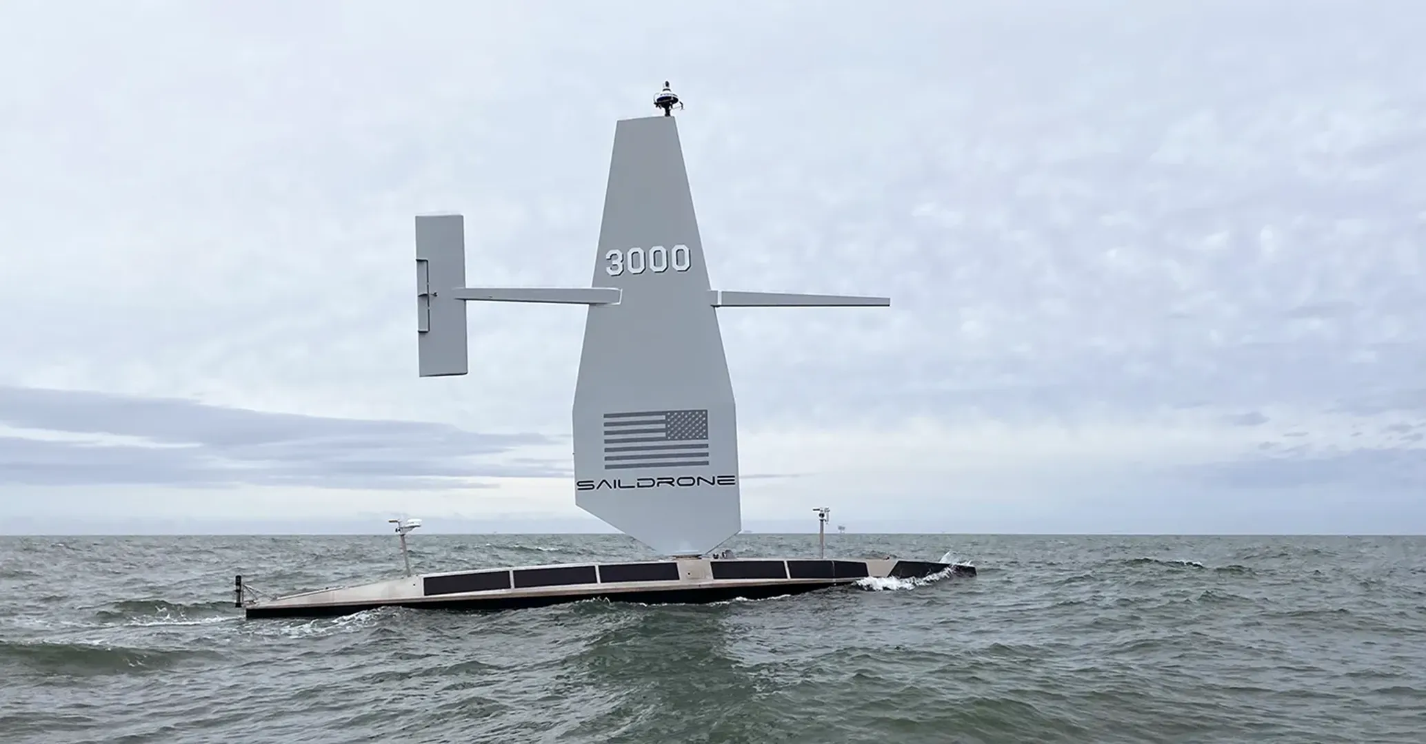
Saildrone provides high-resolution acoustic characterization of the seabed and shallow subsurface, enabling defense and national-security partners to understand what lies beneath critical waterways and infrastructure corridors. Purpose-built for persistence, Saildrone Voyager delivers reliable subsurface intelligence even in contested or resource-constrained regions.
Whether protecting subsea infrastructure, screening for anomalies, or building domain awareness below the seafloor, Saildrone systems deliver actionable insights into the subsurface.
High-resolution imaging of sediment layers and shallow subsurface structure
Detection of buried objects, debris, and manmade infrastructure
Autonomous corridor mapping of pipelines, cables, and critical chokepoints
Wide-area subsurface coverage without crewed-asset risk
Continuous intelligence flow for security, engineering, and mission analysis
Integrated Acoustic Systems for Subsurface Intelligence
Saildrone Voyager carries an industry-standard sub-bottom profiling payload combining acoustic transducers, precision navigation, and onboard automation. These systems operate continuously to deliver clear subsurface imagery along priority routes and sensitive corridors.
High-resolution acoustic penetration for mapping sediment layers, buried features, infrastructure pathways, and potential tampering indicators.
GNSS, inertial sensors, and real-time motion compensation ensure data fidelity in dynamic sea states without dependence on GPS.
Temperature, salinity, and depth measurements support acoustic interpretation and situational understanding.
Pattern-of-life adherence, corridor mapping, and precision line-keeping without human steering.
Encrypted transfer to the Saildrone Mission Portal or integration into your existing geospatial or subsurface-analysis workflow.
Proven in Sensitive, High‑value Maritime Regions
The Saildrone Wing, in addition to augmenting propulsion systems, supports long-duration profiling missions that reduce crew exposure and extend operational reach.
Voyager’s design enables stable acoustic acquisition in demanding sea states and congested maritime regions.
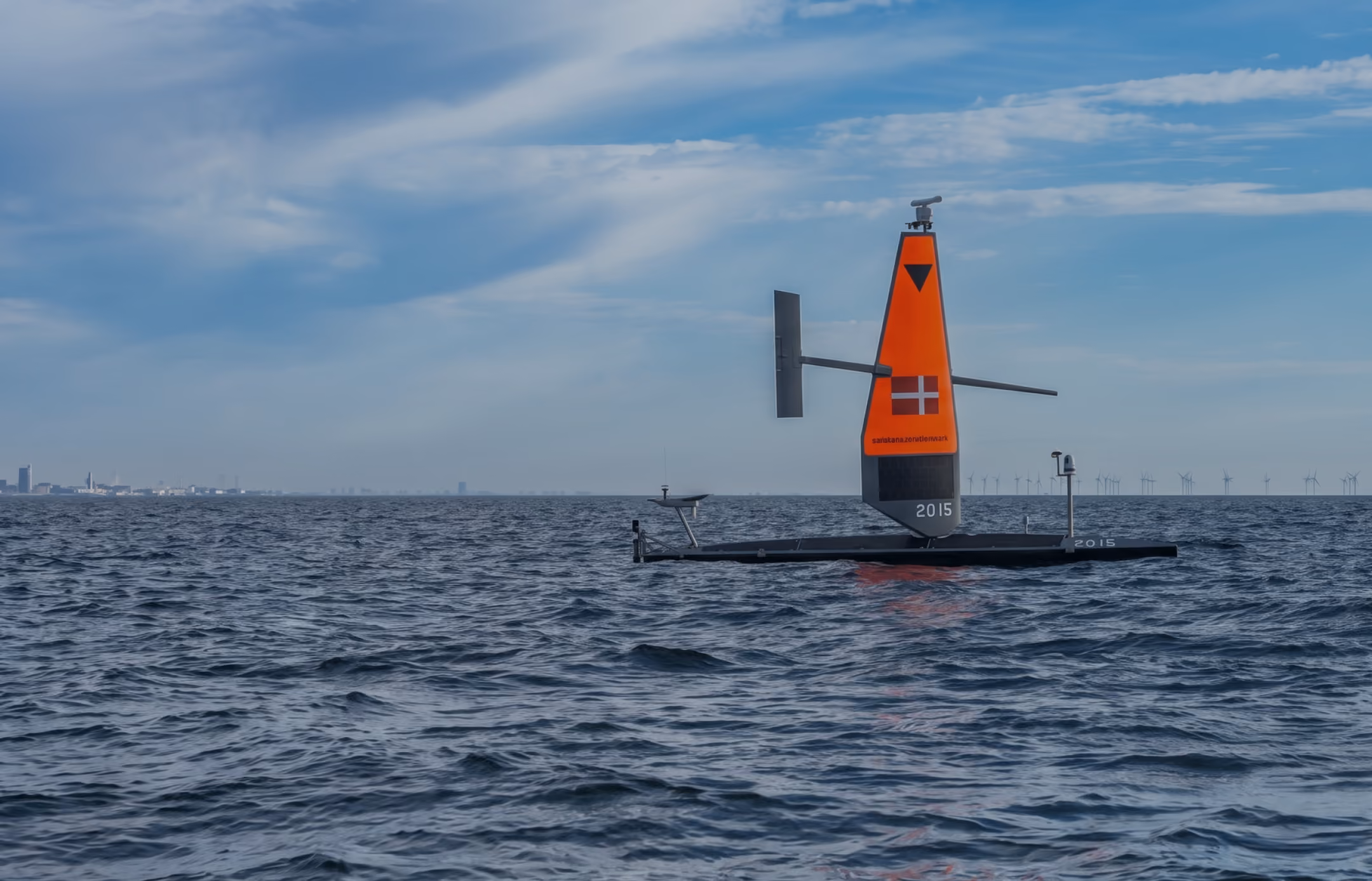
Saildrone USVs can safely survey infrastructure corridors, shallow approaches, and restricted waters unsuitable for large platforms.
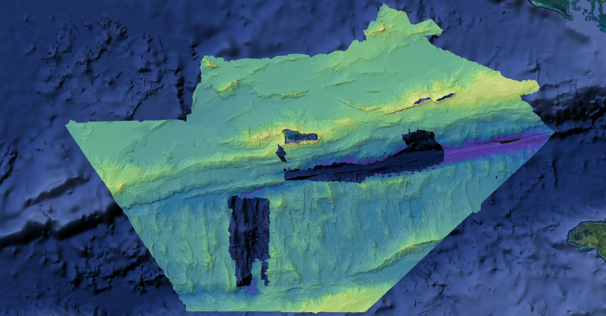
Saildrone conducted sub-bottom profiling in the Baltic Sea—including along portions of the Nord Stream pipeline corridor—as part of a demonstration of regional defense and infrastructure security capabilities.