FULLY MANAGED MISSION SERVICE
Saildrone provides a fully managed Mission‑as‑a‑Service (MAAS) that delivers end‑to‑end autonomous maritime operations, in which Saildrone owns, operates, and services the vehicles, while customers remain in control of mission profiles and deliverables.
In this model, data is delivered seamlessly into existing COPs, allowing customers to deploy assets rapidly without long procurement cycles or capital outlay.
No need to procure, operate, maintain, or integrate new autonomous platforms. Missions can begin immediately using Saildrone-owned assets and established operational infrastructure.
MAAS consolidates acquisition, training, maintenance, logistics, and operational expense into a predictable service model. Partners avoid initial R&D, capital expenses, and long-term platform ownership risk.
Turnkey deployment enables rapid scaling to new regions or mission types in response to emerging threats or evolving needs without procurement lead times or workforce ramp-up.

Augment Assets and Increase Mission Efficacy
Saildrone extends sensing coverage and reduces operator burden by deploying, operating, and maintaining USVs as a managed service. Partners gain access to the Saildrone team of specialized, skilled staff, including Pilots, Mission Managers, and Data Scientists, as well as Saildrone’s deep technical expertise for complex maritime tasks, eliminating the need to hire or appoint additional resources.
Accomplish your mission more efficiently by integrating Saildrone’s advanced technology into the hybrid fleet or hedge force.
Mission Deployment
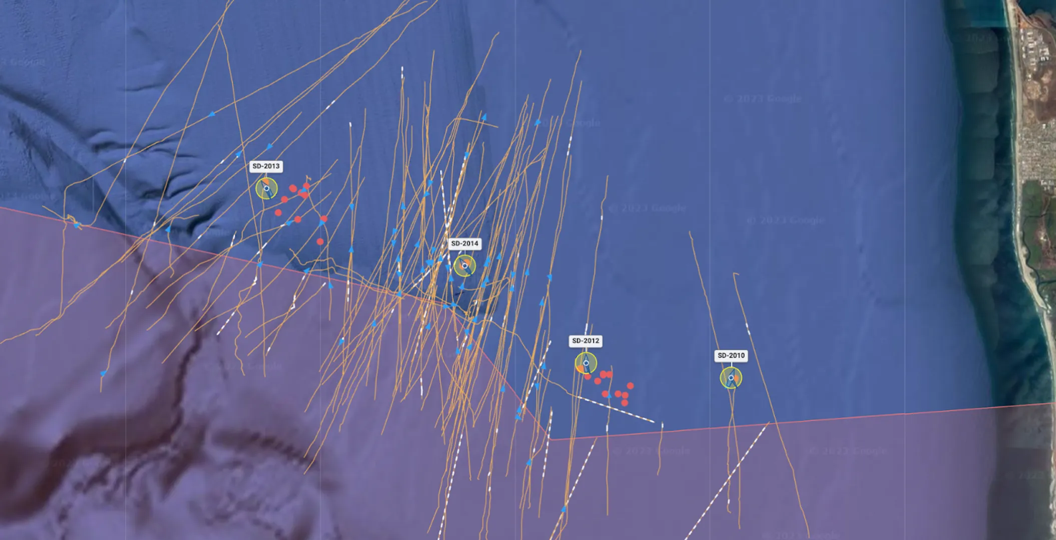
Saildrone handles end-to-end logistics and operations, beginning with mission planning and deployment. Saildrone Mission Management works with operators and customer decision-makers to efficiently and strategically determine deployment zones and pinpoint optimal routes to meet the needs of dynamic mission sets.
Mission Execution
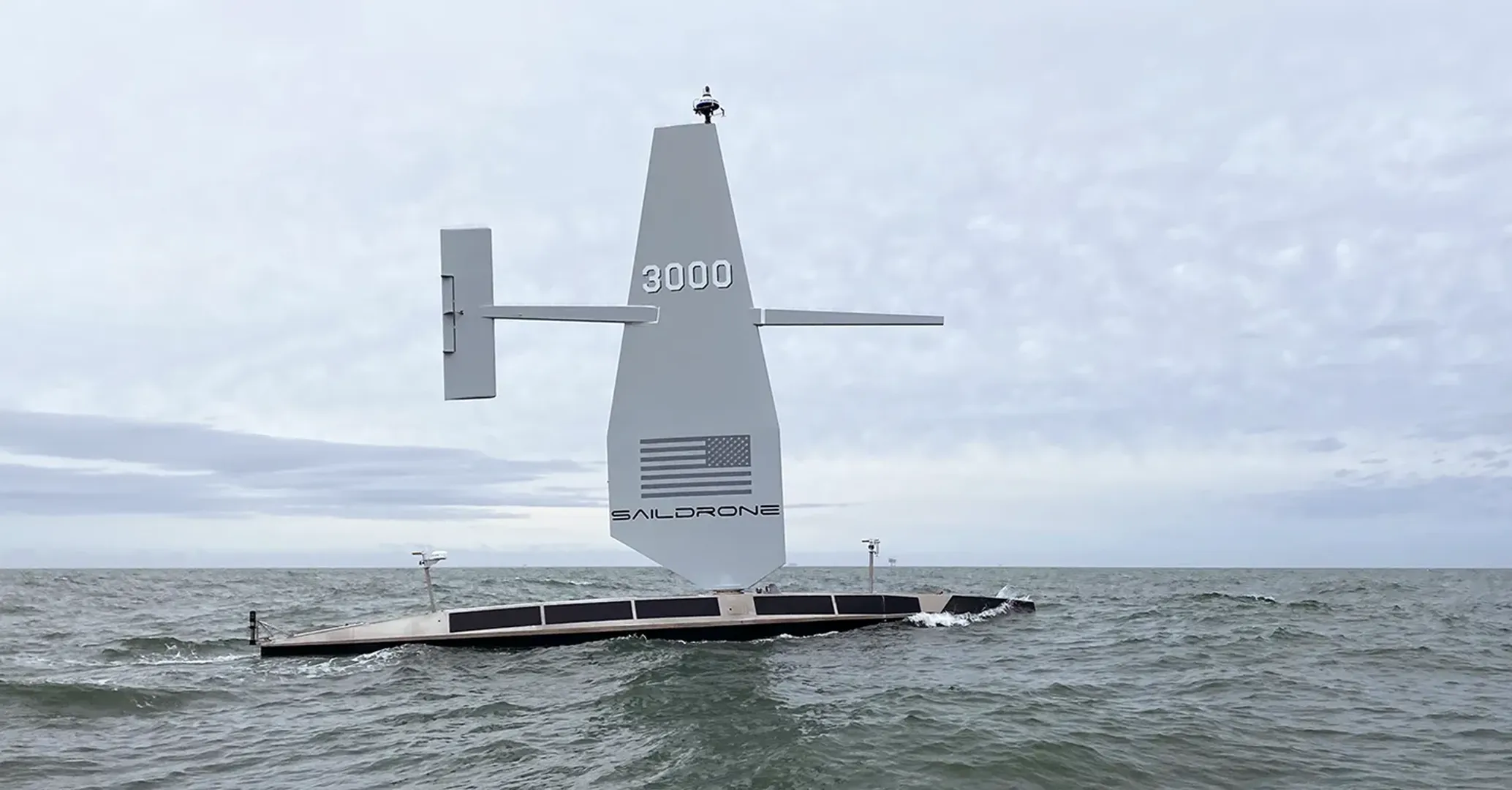
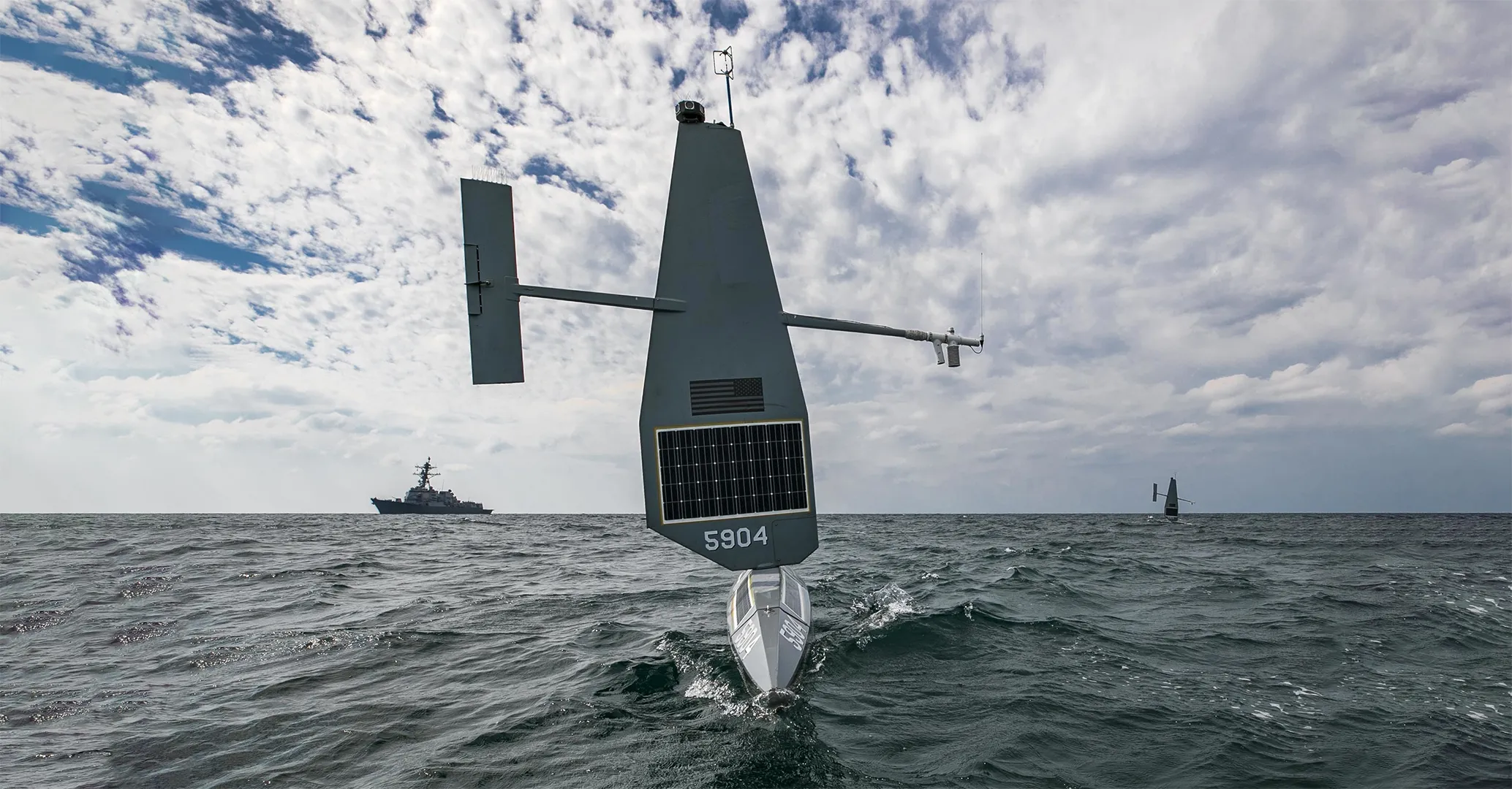
Saildrone USVs remain on mission for months at a time with zero manning burden. Data is accessed 24/7/365 via secure API, which seamlessly integrates into common operating pictures (COPs) and analytical platforms.
Data Delivery
Edge-processed data is delivered in real time, enabling enhanced decision-making and responsiveness.
Post Mission
On mission completion, Saildrone Mission Management oversees all the logistics and operations of fleet recovery.