The NAVOCEANO contract reflects the US Navy’s proactive approach to leveraging unmanned systems for ocean mapping.
US Navy Awards Saildrone Contract for Seafloor Mapping in the Atlantic
Ocean Mapping
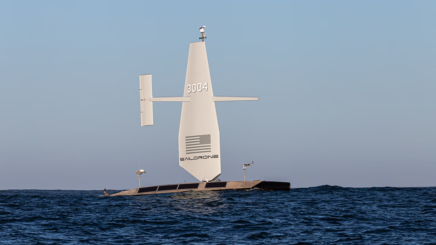
The 20-meter (65-foot) Saildrone Surveyor is a long-endurance, multimission unmanned surface vehicle equipped with deep-ocean multibeam sonar for high-resolution bathymetric mapping.
Published on
September 15, 2026
Location
Alameda, CA
Read time:
5
Minutes
Saildrone today announced a contract from the US Navy’s Naval Oceanographic Office (NAVOCEANO) to conduct bathymetric survey operations in international waters in the Atlantic Ocean.
The contract is a $10 million task order for operations in the Atlantic for ocean floor mapping services in support of NAVOCEANO. Surveying operations are scheduled to begin in 2026 and continue through most of 2027 using Saildrone Surveyor unmanned surface vehicles.
With only 28.7%* of the world’s oceans mapped to modern standards, high-resolution seafloor imagery appears to remain a priority. Accurate bathymetry supports the safe navigation of manned vessels, enhances operational security in contested environments, safeguards critical infrastructure, and expedites search-and-rescue efforts when lives are at risk.
“High-resolution ocean mapping is vital to the US Navy’s maritime superiority and strategic advantage, enabling safe navigation, effective submarine operations, and fleet lethality,” said Saildrone Sr. Dir. Ocean Mapping Kitch Kennedy, USN Capt. (ret.). “This contract to survey vast regions of the Atlantic Ocean, where traditional survey deployments are long and the conditions are unpredictable, is precisely the type of mission that Saildrone’s autonomous technology was designed to execute.”
Saildrone has been conducting bathymetric surveys for US government customers since 2019.
The Saildrone Surveyor is a 20-meter (65-foot) multi-mission USV designed for long-endurance global missions. Equipped with deep-ocean multibeam sonar, the Surveyor collects high-resolution bathymetric data in remote ocean areas, while also supporting persistent maritime intelligence, surveillance, and reconnaissance (ISR) and distributed, long-endurance power projection.
*According to the April 2026 release by the General Bathymetric Chart of the Oceans (GEBCO) Grid.
Contact Us
Jenn Virskus
Director Marketing, Saildrone
Office: (510) 956-8361
jenn.virskus@saildrone.com
About Saildrone
Saildrone designs, builds, and operates commercially developed unmanned surface vehicles for civil, commercial, and government missions. Built to perform in the world’s harshest environments, Saildrone platforms combine AI, advanced sensors, secure communications, and exceptional endurance to deliver persistent, wide-area maritime intelligence and seafloor insight. A modular architecture supports customer- and partner-furnished sensors and mission payloads, enabling multi-domain impact—from power projection and persistent ISR to real-time threat detection and tracking—while reducing cost, risk, and the burden on crewed assets. With proven operational success across the world’s oceans, Saildrone is advancing autonomous maritime operations to give decision-makers and warfighters the enduring advantage they need to act faster and operate farther.