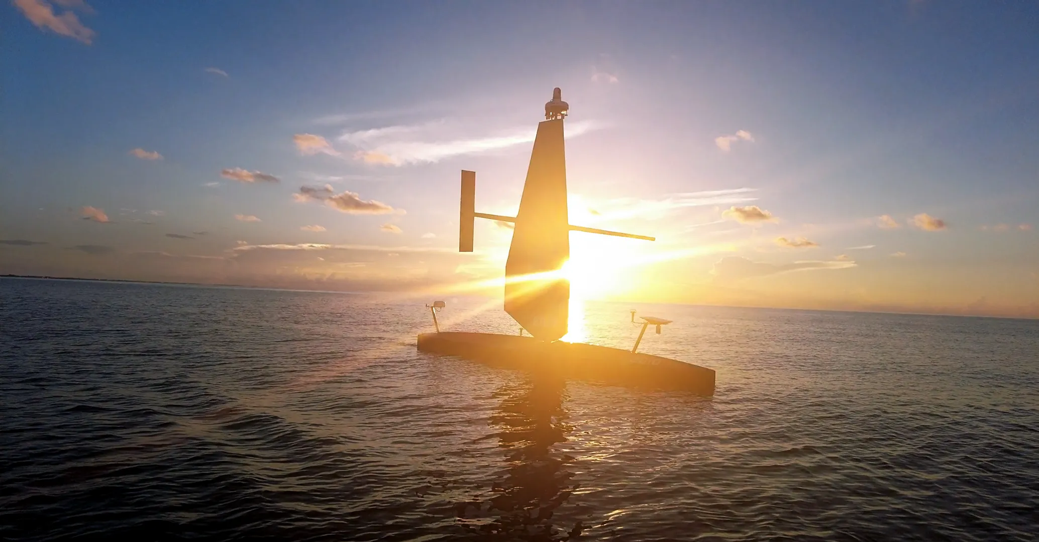
SAILDRONE VOYAGER
[The Ocean is Contested. Persistence Wins.]
[
WHAT Voyager DELIVERS
]
Long‑endurance Autonomy for Homeland Security and Shallow‑water Mapping
10m
33 FEET LENGTH
100
DAYS BETWEEN STOPS
5Kts
SPEED

VOYAGER
A 10-meter unmanned surface vehicle designed for persistent coastal surveillance and nearshore mapping missions. Voyager delivers continuous maritime ISR, seafloor characterization, and real-time domain awareness.
The Saildrone Voyager is the most cost-effective and efficient tool for protecting national interests at sea with zero manning burden.

[
Specs
]
Vehicle
Specifications
A High‑capacity Platform for Advanced Sensor Integration
The Saildrone Voyager provides the endurance and system architecture required to support mission-specific payloads for coastal ISR, seafloor mapping, and maritime safety operations.
LENGTH
10 m
WING HEIGHT
6 m
DRAFT
2 m
PRIMARY PROPULSION
Electric motor
AUXILIARY PROPULSION
Wind (Saildrone Wing)
MAPPING SPEED
5 knots
ENDURANCE
100 days between service stops
PAYLOAD POWER
3.5 kW peak