Published on
Author

The Saildrone 2019 Gulf Stream Data Set is now available on the European Marine Observation and Data Network (EMODnet).
EMODnet, a European Union initiative, is a network of organizations working together to gather valuable marine data and make it readily available and easily accessible to a wide range of public and private organizations. The website is divided into seven discipline-based themes: bathymetry, geology, seabed habitats, chemistry, biology, physics, human activities. The Saildrone Gulf Stream data set will be hosted in EMODnet’s physics portal.
“We’re incredibly happy and honored to be an associated partner of EMODnet and part of the global ocean observing system as a whole,” said Elizabeth Douglas, head of International Partnerships at Saildrone. “Our hope is that EMODnet users that access Saildrone fit for purpose data will use it to develop solutions that contribute to the blue economy and also result in positive societal benefits tackling some of the most pressing global challenges, such as ocean acidification.”
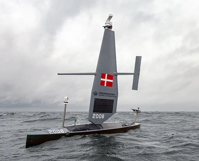
Saildrone’s unmanned surface vehicles (USVs) make ocean data collection possible and cost-effective at scale. Each USV carries a payload of science sensors to collect valuable data above and below the sea surface.
In January 2019, SD 1021 was launched from Newport, Rhode Island, in collaboration with the University of Rhode Island’s Graduate School of Oceanography professor Jaime Palter. The scientific objective of this campaign was to quantify wintertime air-sea heat and carbon exchange in the Gulf Stream while also assessing the saildrone as a potential platform to reduce uncertainties and build a mechanistic understanding of the key time/space scales and processes governing these exchanges in Western Boundary Current regions.
The North Atlantic Gulf Stream region often receives strong weather systems and winter storms that make ship-based observations difficult to collect. Throughout the 27-day mission, which was supported by a Saildrone Award, SD 1021 also carried an ASVCO2 system provided by NOAA/ PMEL and an Acoustic Doppler Current Profiler (ADCP) in addition to the core sensor suite. Using a saildrone to collect data during the winter can help increase our understanding of processes driving the update of carbon dioxide and its role in weather.
“The data collected during the 2019 Gulf Stream mission was collected with the intent that it would be public,” said Kimberly Sparling, Senior Product Manager of Data Services at Saildrone. “We highly encourage interested parties to download and review the data to develop an understanding of Saildrone’s data capabilities.”
For the past five years, Saildrone has partnered with scientific institutions such as NOAA, NASA, IMR, and many others, to collect atmospheric, oceanographic, and biogeochemical data from across the world’s oceans. The result is a growing in situ data asset that provides an ongoing view of the marine environment.
“EMODnet’s partnership with Saildrone will be invaluable to the future of our in situ biogeochemical and carbon data distribution to the European and global community—users of EMODnet, SeaDataNet, and Copernicus Marine Service. We are looking forward to having more data sets available across EMODnet portals in the future,” said Douglas.
Access the data set here.
Resources
Belén Martín Míguez, Antonio Novellino, et al., “The European Marine Observation and Data Network (EMODnet): Visions and Roles of the Gateway to Marine Data in Europe,” Frontiers in Marine Science, July 12, 2019