The 2018 West Coast Fisheries Survey combined the efforts of a NOAA research vessel and a fleet of saildrones to observe and collect data on fish and marine mammals from anchovy to humpback whales.
Assessing Fish Abundance on the West Coast in 100 Days
Published on
February 6, 2019
Read time:
5
Minutes
Scientists and saildrones completed a 100-day mission from Vancouver Island to San Diego to assess fish stocks, count marine mammals, and test how unmanned surface vehicles (USVs) can augment ship-based sampling. The landmark survey, which wrapped up in November, is the result of a public-private collaboration between NOAA’s Northwest and Southwest Fisheries Science Centers, NOAA’s Pacific Marine Environmental Laboratory, and Saildrone.
The 2018 West Coast Fisheries Survey is the first time autonomous wind and solar-powered vehicles have been used to gather essential data on West Coast fish populations. It’s also the first time researchers counted and observed such a wide range of species. NOAA Fisheries regularly conducts surveys off the West Coast, but typically, studies of predators and prey are performed separately.
“This survey was novel because it combined observations of zooplankton, fish, marine mammals, and seabirds throughout the California Current Ecosystem. In this way, we may be able to directly estimate the amount of fish and krill consumed by their natural predators,” said David Demer of the NOAA Southwest Fisheries Science Center, who led the survey of pelagic fishes and krill.
“We also learned some ways that Saildrone technology can sample where, when, and how the ship cannot effectively or economically sample.”

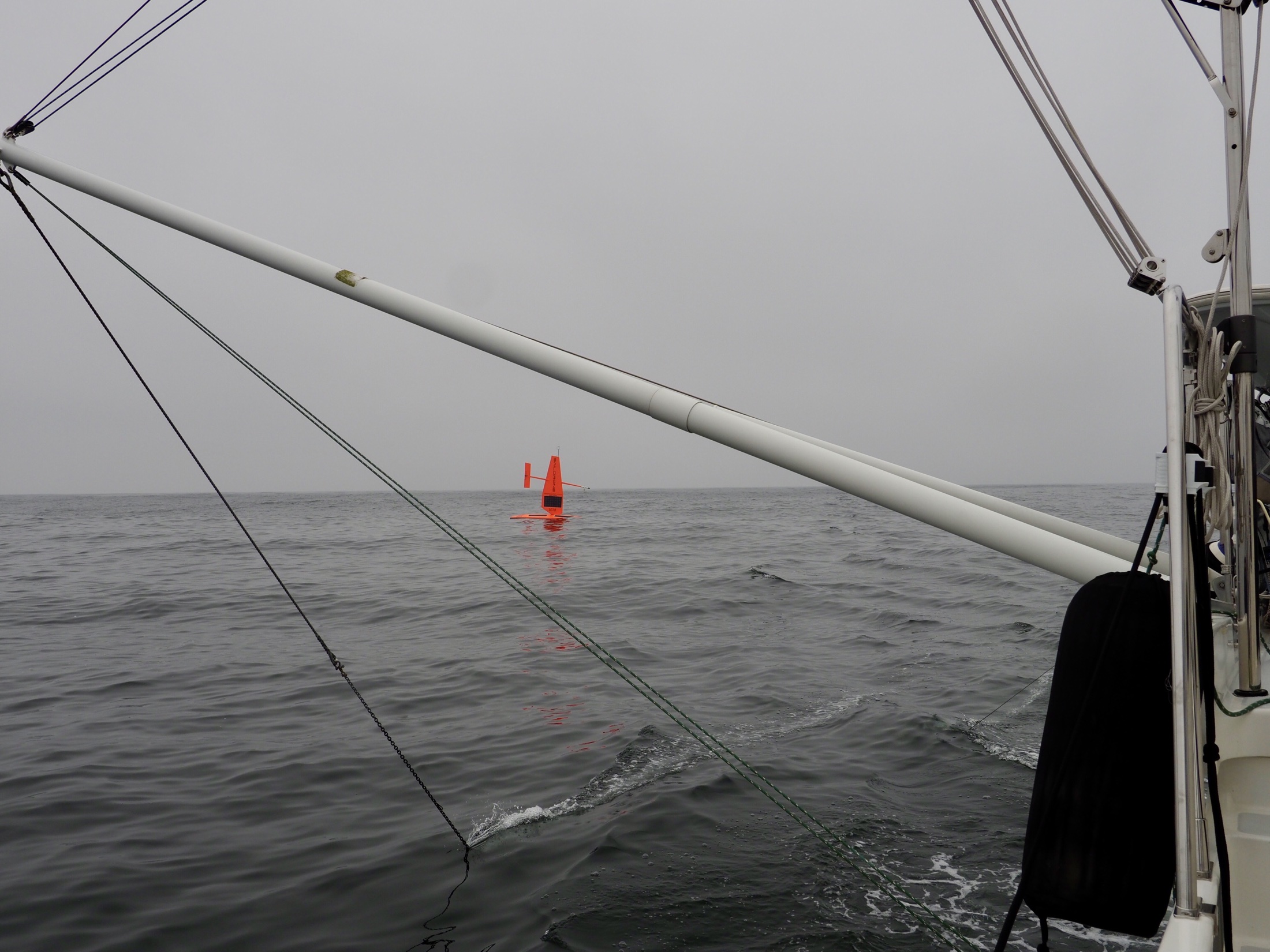
Five Saildrone unmanned surface vehicles (USVs) worked alongside the NOAA research vessel Reuben Lasker, traveling more than 18,500 nautical miles over the course of the survey. The USVs were equipped with a suite of instruments, including sonar to detect large schools of fish. “That sound bounces off of the fish schools and the intensity of those echoes tells how many fish are in the ocean,” said NOAA researcher Juan Zwolinski.
Four of the saildrones duplicated the path of the Reuben Lasker collecting data on sardine, anchovy, and hake, one of the West Coast’s most valuable commercial fisheries. The fifth saildrone collected data close to shore in water too shallow for NOAA ships to safely navigate.
Scientists will be analyzing the enormous amount of data collected by the Lasker and the saildrones for months to come (some saildrone data was transmitted in real time via satellite and the rest downloaded upon retrieval) and expect to gain a better understanding of how different predator species may be affected by changes to the availability or migratory patterns of prey.
Aboard the ship, researchers documented the largest number of marine mammal sightings during a single survey ever conducted by the Southwest FSC—more than 1,400 species from blue whales to dolphins. They counted more than 600 humpback whales alone. Fisheries survey leaders reported that the saildrones were instrumental in making the project as comprehensive as it was.
“This is a brand-new tool in our toolkit,” said Christian Meinig, engineering director for NOAA’s Pacific Marine Environmental Laboratory in Seattle.
“We’re never going to be able to get rid of the ships, but these vehicles can augment those surveys, fill in the gaps, and help us use our ships in a smarter way.”
Must Read


[
NEVER MISS AN UPDATE
]
Stay informed with the latest research findings and updates.
By clicking Sign Up you're confirming that you agree with our Privacy Policy.
