Published on
Author
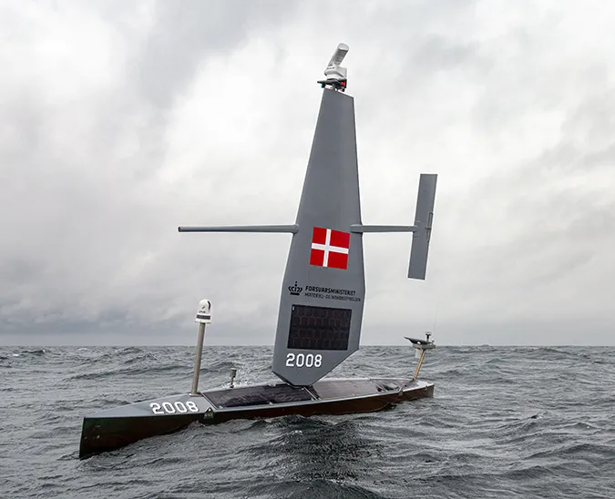
Two Saildrone Explorers have wrapped up Saildrone’s second fishery mission in the Great Lakes for the US Geological Survey’s Great Lakes Science Center (GLSC). The vehicles each spent 25 days on Lake Superior measuring fish distributions and densities around the clock. The GLSC is using advanced technologies to carry out a large-scale, multi-partner project to study how existing hydroacoustic methods can be improved to provide more accurate and precise estimates of fish populations in the Great Lakes.
USGS is signatory to a memorandum of agreement with the binational Great Lakes Council of Lake Committees—comprising the senior fishery management officials on each Great Lake—to conduct fisheries assessments on the Great Lakes. Some of these annual research-vessel-based assessments of prey fish abundances on Lake Erie, Lake Huron, Lake Michigan, Lake Ontario, and Lake Superior have been carried out since the mid-twentieth Century.
Prey fishes are the species in the middle of the food chain eaten by economically and culturally valuable predators like lake trout, Chinook salmon, lake whitefish, walleye, and yellow perch. Understanding the annual population dynamics of these small, silver “bait fish” is of paramount importance to Great Lakes fishery managers. The quality of USGS interjurisdictional fishery assessments—some of which are transboundary between the US and Canada—has a direct impact on fishery management decisions that are based on USGS’s data. These decisions include setting catch quotas and predator stocking targets.
“The accuracy of the data we collect is of paramount importance, particularly now, because we’re at a time of low fish abundances in the Great Lakes compared to the mid-twentieth century,” said Peter Esselman, a USGS biologist and the project lead.
%2520Ashland%2520Advanced%2520Tech%2520Event%2520-%2520Credit%252C%2520Andrea%2520Miehls%252C%2520USGS-750px.webp)
USGS uses hydroacoustics, or underwater echo sounders, as one method to assess prey fish populations. USGS is working to address two sources of potential bias in hydroacoustic assessments using advanced technologies: whether the noise of diesel-powered research vessels influences fish abundance estimates and whether fish near the surface are being missed by vessel-based echo sounders, which are deployed up to 12 feet below the water surface.
In other water bodies, fish have been shown to flee the vicinity of research vessels because of the noise coming from the large diesel engines. Wind and solar-powered Saildrone USVs are virtually silent and carry the same echo sounders used by the research vessels. By conducting comparative surveys using Saildrone USVs alongside traditional research vessels, scientists will be able to ascertain whether vessel noise affects fish stock estimates. “In order to test the question of how biased our surveys are due to vessel noise, we need to have estimates without vessel noise. The Saildrones have been essential for providing a benchmark against which to test the noise-affected fisheries estimates,” said Esselman.
In a concurrent experiment, the USGS is also using an upward-facing echosounder carried by one of the Monterey Bay Aquarium Research Institute’s autonomous underwater vehicles (AUVs), which cruise at mid-depth in the water column. Because the AUV is also deployed alongside traditional research vessels, this approach will allow scientists to ascertain whether prey fish at the surface are missed in vessel-based hydroacoustic assessments.
SD 1063 is one of two Saildrone Explorers deployed to Lake Superior this summer. Video: Don Jaskowiak.
Invasive species are one of the primary challenges facing the lower four Great Lakes: Since around 2000, lakes Erie, Huron, Michigan, and Ontario have undergone a whole system shift due to the invasion of dreissenid zebra and quagga mussels. Native to the Ponto-Caspian region of eastern Europe, this bottom-dwelling filter-feeder was first discovered in the US in 1989, brought by cargo ships using the Saint Lawrence Seaway. While not all non-indigenous species are harmful to the ecosystem, quagga mussels have clarified the water and competed with Great Lakes prey fish for plankton.
Unlike the lower four lakes that contend with extensive invasive species and other stressors associated with a warmer climate and more intense land use, Lake Superior has a largely native food web. The major concern is protecting valuable fisheries to ensure their sustainability over time. However, climate change could bring other new threats as the lakes warm.

In previous fisheries missions on the US West Coast, the Bering Sea, and the North Sea, Saildrone Explorers have been demonstrated to be quiet, high-endurance, persistent, and capable of collecting high-quality fisheries data 24/7. “One thing we’ve learned is that there’s a sweet spot for when we get good data with the USVs compared to the vessels. There needs to be enough wind to propel Saildrone [vehicles], but not too much to make operating vessels dangerous. Because we’re doing comparative work, we have to find that sweet spot, but we’ve been able to do that with good success.”
While Saildrone USVs are known as “ocean drones,” Esselman says they are appropriately scaled to the Great Lakes, which are more like inland seas than lakes. The Great Lakes are the largest freshwater system in the world and account for one-fifth of Earth’s available surface freshwater. They cover 94,250 square miles (244,160 square kilometers)—slightly less than the state of Oregon. The lakes provide clean drinking water for more than 40 million people in the US and Canada and support a commercial, recreational, and tribal fishery valued at $7 billion. “Ocean-going technology is appropriate for such a large lake system, and it’s been pretty easy to operate Saildrones in the Great Lakes,” he said.
Data collection is only one half of Saildrone’s product. The other half of that is data visualization and delivery. The Saildrone Mission Portal offers customers the ability to track data in near real time and make on-the-fly adjustments to the mission plan based on the intelligence being returned from the vehicles.

“Having the ability to tap into Saildrone’s real-time data feed with all the wave and wind measurements allowed us to plan our missions effectively and be strategic in how we’re operating,” said Esselman.
The USGS is working with Cornell University to analyze the data, a process that takes about a year. The team is currently compiling results based on the 2021 data collected in lakes Michigan and Huron. The results will be publicly available once the peer review process is complete.
The primary objective of USGS is to improve conventional vessel-based hydroacoustic survey results by assessing and correcting potential bias using Saildrone data for comparison. The secondary, long-term objective is to assess whether USVs can supplement vessel-based fishery assessment efforts with ongoing USV surveys. Even though USGS research vessels spend dozens of weeks on each Great Lake throughout the field season each year, these efforts are still only able to measure a small portion of each lake in a given year.
USGS hopes to continue the research with additional on-the-water surveys in lakes Michigan, Huron, and Erie.
Resources
Great Lakes Science Center, “Use of Advanced Technologies to Improve Fisheries Assessments on Lake Superior,” usgs.gov, August 1, 2022
USDA National Invasive Species Information Center, “Quagga Mussel,” webpage, invasivespeciesinfo.gov, accessed on January 4, 2023
Blaine Friedlander, “Cornell Group to Comb Data from Lake Superior Sailing Drones,”Cornell Chronicle, August, 16, 2022


