Published on
Author
An oil seep is a fracture on the seafloor through which crude oil and natural gas leak or “seep” out of the earth and into the water. Global estimates suggest that naturally occurring oil seeps account for some 47% of the oil released into the ocean environment; on average, 160,000 tons of petroleum leak into waters surrounding North America each year. Saildrone worked with the ECOGIG consortium to locate natural oil seeps in the Gulf of Mexico and study how fine-scale environmental variables like wind speed and surface currents affect the size and duration oil slicks created by natural seeps.
ECOGIG (Ecosystem Impacts of Oil and Gas Inputs to the Gulf) is made up of physical oceanographers, marine biologists, and biogeochemists from more than two dozen universities and research institutions. The project studies natural hydrocarbon seeps in the Gulf of Mexico to understand how hydrocarbons move through and transform the ocean environment and tracks the impacts of the 2010 BP/Deepwater Horizon oil spill on the Gulf ecosystem.

Satellite synthetic aperture radar shows persistent oil slicks in the Gulf of Mexico. Green Canyon 600 (GC600) is thought to be one of the most prolific natural seeps in the region. Oil released from a natural seep rises to the sea surface and spreads out into a thin layer. An oil slick remains visible on the surface until it weathers and disperses. On average, natural slicks remained on the surface for about six hours. Researchers wanted to study how wind and currents affected the length of the oil slick and the amount of time it remained on the surface.
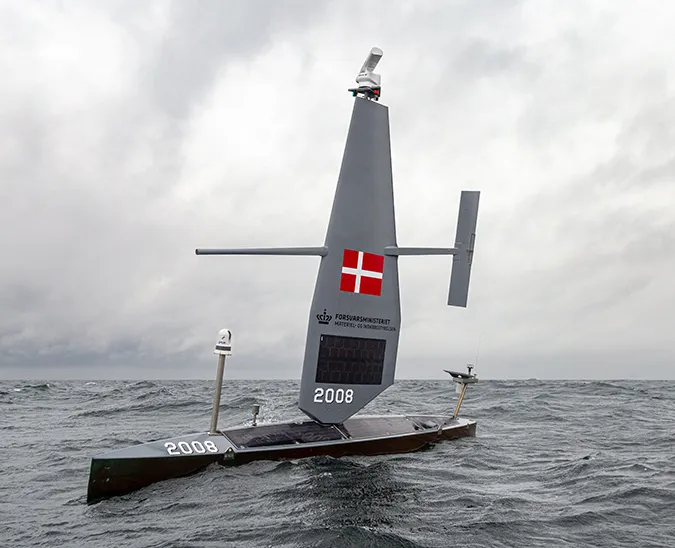
A Saildrone unmanned surface vehicle (USV) was deployed out of Cocodrie, LA, and sailed through a dense field of oil platforms to reach GC600, approximately 200 nautical miles offshore. Saildrone USVs carry a suite of science sensors to collect data above and below the sea surface. For the Gulf mission, a remote optical watcher (ROW) from Laser Diagnostics Instruments was affixed to the bow of the saildrone. The ROW detects the presence of oil by its natural fluorescence.

After successfully locating the seep, which was confirmed by an overflight, SD 125 surveyed the area for three weeks sailing a pattern of transects in the vicinity of GC600 and then returned autonomously to port. The saildrone transited between regions where surface oil is common to control regions where there is no natural seepage. The entire mission lasted approximately one month and covered some 1,500 nautical miles.
The goal of the mission was to understand the long-term impacts of natural seepage versus anthropogenic spills (e.g., the Deepwater Horizon accident) on deepwater ecosystems and the mechanisms for recovery. A better understanding of how oil moves with wind and currents can improve the use of remote sensing and response time to oil spills.
Results from the Saildrone mission showed that surface winds are largely responsible for the dispersal of oil slicks from the sea surface and higher winds reduce the length of slicks. Likewise, surface currents lengthen natural oil slicks, and very long slicks don’t necessarily indicate a change in the release of oil from natural seeps. The saildrone also proved to be useful for identifying narrow oil slicks under open ocean conditions.
The Gulf of Mexico is an incredibly congested area with thousands of oil platforms, ships, and oil and gas pipelines. There are more than 25,000 miles of active oil and gas pipelines in the Gulf, enough to reach around the Earth at the equator—and then some! This mission further demonstrated the ability of Saildrone USVs to navigate precisely and safely in the most challenging marine environments.
Dr. Samira Daneshgar-Asl of the University of California Santa Barbara discusses her work using the Saildrone USV to detect natural oil seeps in the Gulf of Mexico.
Read more about this mission: “Hindcast modeling of oil slick persistence from natural seeps” and “Maritime Advanced Geospatial Intelligence Craft for Oil Spill Response: Selected Resources and Annotations.”
Main photo: A Saildrone USV surveying natural oil slicks in the Gulf of Mexico as captured by an overflight.


