Published on
Author
An eddy is a swirling water mass found in oceans, lakes, and rivers. Depending on where and how they are formed, in the ocean, eddies can range in size from a few hundred meters to several hundred kilometers and can be thousands of meters deep. Off the west coast of Africa, the interplay of winds, currents, and coastal topography create eddies up to 100 kilometers in diameter, which can migrate from the coast west across the Atlantic for several months, or sometimes, several years at a time. Eddies can be difficult to detect and have been often overlooked, but recent limited observation has revealed that these enormous whirlpools of water are hot spots of biological productivity and play an important role in the distribution of energy, oxygen, and nutrients.
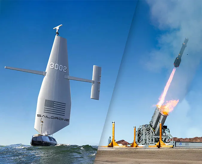
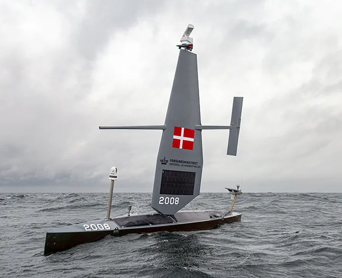
The 2019 Saildrone Atlantic to Mediterranean (ATL2MED) mission brings together 12 oceanographic research institutions from seven countries to accomplish a variety of scientific goals. The first phase of the mission consists of an eddy survey, known as the #MOSESeddyhunt, led by Chief Scientist Arne Körtzinger from the Helmholtz Centre for Ocean Research (GEOMAR) based in Kiel, Germany. Two Saildrone unmanned surface vehicles (USVs), deployed from the Canary Islands off the northwestern coast of Africa, transited south to Cabo Verde to join this first-of-its-kind survey.
“In the past, the large ocean currents, for example, the Gulf Stream, were imagined as continuous bands. Today, thanks to numerous measurements and satellite observations, we know that currents are in fact quite turbulent. In order to understand how the physics, biogeochemistry, and biology of the ocean interact within these eddies, we need to study them in more detail and in a systematic way. This will help us to better ascertain their role in the ocean ecosystem on a regional and global scale,” explained Dr. Björn Fiedler, a research scientist at GEOMAR and one of the mission’s principal investigators.

The Canary Current Upwelling System (CanCS) hosts one of the world’s most productive ecosystems. Fishing is a primary source of income and sustenance for the communities on the coast of West Africa, and the region is actively fished by commercial and local fishermen. However, the CanCS is also vulnerable to climate change related to rising sea temperatures, ocean acidification, and deoxygenation. In 2010, a large eddy passed directly by the Cape Verde Ocean Observatory (CVOO), a long-term observatory north of the Cabo Verde Islands. Observations made at 50 meters of water depth for one month showed that the eddy was virtually devoid of oxygen.
“At first, we thought that this was a temporal sensor failure, but then we realized that it was associated with the passage of an anticyclonic eddy that was running through the CVOO site,” said Fiedler.
A small study in 2014, led by the Future Ocean Excellence Cluster at Kiel University and GEOMAR, provided the first opportunity for targeted sampling of an almost oxygen-free eddy and revealed processes that were previously unknown in the Atlantic, but there remain many questions about the role and function of eddies.

The #MOSESeddyhunt is a multicomponent field study involving a team of chemists, biologists, and physicists on board the German research vessel Meteor, the two saildrones, and a variety of other unmanned technologies including nearly a dozen gliders plus Wave Gliders, floats, and drifters. Also, a high-performance research motor glider plane supports the mission with aerial measurements. The mission explores the physics that drive biogeochemical processes inside eddies, as well as the impact such extreme eddies have on the local ecosystem and fisheries.
One of the two saildrones, SD-1030 is equipped with an Acoustic Doppler Current Profiler (ADCP), in addition to the standard Saildrone sensor suite, which includes instruments to take meteorological and oceanographic measurements above and below the sea surface. The saildrone will serve as a “scouting” vehicle, searching for eddy candidates as well as conducting high-resolution surveys of certain aspects of the eddies with its onboard sensors. When an eddy candidate is identified, Körtzinger’s team on the Meteor will arrive to conduct further research while the saildrone scouts for the next candidate.
“The saildrones are an excellent example of combining autonomous platforms with vessel-based approaches. Since some of the eddies are not that easy to observe from space with satellites, we need the saildrones to do a pre-survey of the region to look out for suitable candidates. Otherwise, we would need to spend about 40% of our very expensive and valuable ship time searching for these eddies,” said Fiedler.

The second saildrone, SD-1053, is equipped with a Simrad EK80 echo sounder, which collects hydroacoustic data in the water column. The standard Saildrone sensors include a CTD to measure the conductivity, temperature, and pressure of seawater, as well as sensors to measure oxygen and salinity, which are particularly relevant to studying ocean ecological processes. SD-1030 is also equipped with an ASVCO2 developed by NOAA/PMEL to measure the partial pressure of carbon dioxide (pCO2).
“The saildrones are being used in a concerted way along with the other platforms—subsurface ocean gliders, three biogeochemical Argo floats, and two Wave Gliders. However, the saildrones are a very fast platform and they can survey the exclusive economic zone (EEZ) waters of Cabo Verde much faster than the others. We can easily send them from one corner of the survey area to the other, thereby interconnecting all the platforms on the water. They are an integrative piece in our ‘survey chain,’” said Fiedler.
Once the #MOSESeddyhunt is complete, the two saildrones will transit north to perform cross-calibration of European Research Infrastructure (RI) sites, including CVOO, and validation of carbon measurements.
Resources
Björn Fiedler, “#MOSESeddyhunt: Segelnde Messroboter Gesichtet / Sailing Measuring Robots Sighted,” Cape Verde Blog, Ocean Science Centre Mindelo, accessed December 3, 2019
Björn Fiedler, Damian S. Grundle, et al., “Oxygen utilization and downward carbon flux in an oxygen-depleted eddy in the eastern tropical North Atlantic,” Biogeosciences, 13(19), October 10, 2016
Gerhard Fischer, Johannes Karstensen, et al., “Bathypelagic particle flux signatures from a suboxic eddy in the oligotrophic tropical North Atlantic: production, sedimentation, and preservation,” Biogeosciences, 13(11), June 2, 2016
GEOMAR Helmholtz Centre for Ocean Research Kiel, “MOSES hunts Ocean Eddies,” November 22, 2019


