Published on
Author
The Gulf Stream is the best-known of the five western boundary currents—strong, fast-flowing ocean currents that carry warm water from the equator to the poles. They are hugely influential on weather and climate and hot spots for carbon uptake. The Gulf Stream is also a notoriously rough ocean region and difficult and dangerous for in situ data collection, especially in winter when frigid, violent storms barrel across the North Atlantic.
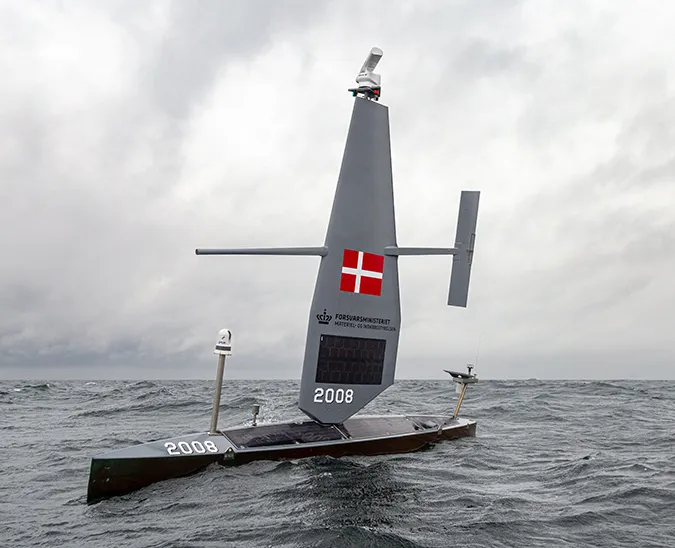
Saildrone’s 2022 Gulf Stream mission will create a first-of-its-kind data set: Three Saildrone Explorer uncrewed surface vehicles (USVs) were deployed from Newport, RI, to spend the next six months sailing back and forth across the Gulf Stream in some of the roughest ocean conditions on Earth collecting ocean data to improve weather forecasting and reduce uncertainties in how much carbon dioxide the ocean absorbs. Funded by a more than €1m grant from Google.org, the mission is being led by scientists at the European Centre for Medium-Range Weather Forecasts (ECMWF) and the University of Rhode Island (URI).

“The winter 2022 Gulf Stream mission is going to create a data set on a spatial and temporal scale that we’ve never had before. We were asked to identify the area of ocean that long-term persistent observation would have the most significant impact on improving weather forecasting, and it’s undoubtedly the Gulf Stream,” said Philip Browne, a researcher at ECMWF and co-principal investigator on the mission.
The Gulf Stream mission will collect data to support two concurrent science investigations: Researchers at ECMWF will examine the precise location of the Gulf Stream and the sharp temperature differences where warm and cold waters collide, and researchers at the URI Graduate School of Oceanography will study how, where, and how much human-produced carbon dioxide the Gulf Stream can absorb.

One vehicle will be stationed “upstream”, east of Cape Hatteras, NC, where the current is like a narrow river of water, a second will be stationed mid-stream, and the third will be stationed “downstream” off the Grand Banks of Newfoundland where the current broadens, meanders, and breaks into eddies. All three vehicles will sail back and forth across the current to capture as many ocean features as possible.
In addition to the standard suite of oceanographic and meteorological sensors, the Saildrone Explorers will also carry an ASVCO2 sensor, designed by the National Oceanographic and Atmospheric Administration (NOAA)’s Pacific Marine Environmental Laboratory (PMEL) and built by Saildrone, and Acoustic Doppler Current Profilers (ADCP) to measure the speed and direction of subsurface ocean currents.
Watch as SD 1091 sails through Narragansett Bay on its way to a six-month mission in the Gulf Stream! Videography: Alex DeCiccio for The University of Rhode Island.
How much CO2 can the ocean absorb?
Winter storms in the North Atlantic carry cold air from the continent over the ocean. These storms extract an extraordinary amount of heat from the Gulf Stream, and the colder water can absorb more CO2. Winter storms also make the ocean more turbulent, mixing the ocean vertically and exposing a larger volume of water to the atmosphere, and strong winds help to drive atmospheric CO2 into the ocean. A portion of the Gulf Stream waters travel northward, becoming colder and denser, until they sink into the deep ocean, carrying absorbed carbon with it, which can be locked away for centuries.
The Global Carbon Budget 2021, released at COP26, uses ocean carbon uptake estimates generated by models and sophisticated statistical methods to fill gaps where in situ data is lacking. The models work well, despite a scarcity of data, but they can’t yet reconstruct all the rich, spatial patterns in the dynamic ocean environment, and still have uncertainties that preclude efforts to use these estimates to help verify nationally-reported emissions. In addition, without resolving the spatial patterns of ocean carbon uptake, it is hard to understand how ocean circulation changes will influence the delivery mechanism of anthropogenic carbon from the ocean surface to its depths.

“There is a lot of uncertainty in ocean carbon uptake—nearly 4 billion tons of CO2 separates the average of the model-based estimates from observation-based estimates. That’s nearly as much CO2 as is emitted by the US [about 5 billion] each year!” said Jaime Palter, a URI oceanographer and a co-principal investigator of the mission.
Palter and her team at URI will use the data collected during the mission to make maps of air-sea carbon exchange across the Gulf Stream at an unprecedented resolution. The maps will provide more precise information about carbon uptake in the Gulf Stream and a better understanding of the mechanics of that process.
“During our first mission in 2019, we learned a great deal. We had a single Saildrone Explorer operating in the Gulf Stream for about 18 days. In that short period, we collected as many ocean CO2 measurements in the Gulf Stream for the month of February as had ever been recorded in the entire history of oceanography for that month,” said Palter.
“If everything goes according to plan, the winter 2021/2022 will soon be the best observed for ocean and atmosphere CO2 in a western boundary current region in any ocean basin over all time. And we are going to be able to do so much with this data set!”
In weather forecasting, better inputs yield better outputs
Most people are concerned with what the weather will be tomorrow or in a few days, and short-term weather forecasting has dramatically improved in recent decades. But medium and long-range weather forecasting, 10 days out and further, is still difficult. ECMWF’s Earth system model couples the atmosphere with the ocean, ocean waves, sea ice, and land, all of which have a significant impact on the evolution of weather. The initial state of conditions fed into the model have to be as accurate and realistic as possible—lack of in situ observation in areas like the Gulf Stream can throw weather models off.

“Satellite data has shown that there are errors in the model, but it doesn’t show why those errors are occurring. If sea surface temperature fronts in the western boundary currents shift by a few hundred kilometers, you can have a 10°C shift in water temperature, which can dramatically shift the forecast compared to reality,” explained Browne.
Accurate long-range weather forecasting not only helps to save lives in the event of an impending natural disaster, but it also helps to improve energy management, potentially saving money and resources.
A storm coming across the Atlantic may hit Southern Europe, its clouds reducing solar power generation. If it hits Northern Europe, it might increase wind power generation. A winter storm could mean people need more energy to heat their homes, increasing demand on the grid. Knowing where and when to expect extreme weather allows energy managers to make more informed decisions about power generation and consumption weeks and even months in advance.

“Saildrone Explorers carry such a variety of instruments, and we’ll be looking at all the different observations from the saildrones, from the wind to the waves, and especially the ADCP, which will give us a 3D picture of the subsurface currents. With all three vehicles sampling at once over a long period of time, we expect to gain new understanding of ocean processes in this region,” said Browne.
A proven platform
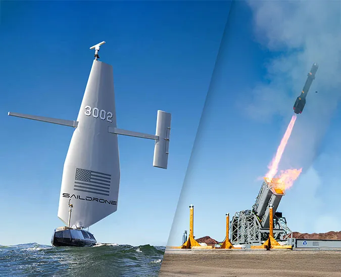
Saildrone USVs are highly maneuverable, wind and solar-powered vehicles designed for long-range data collection missions. The impressive capabilities of Saildrone’s autonomous vehicles have been proven in numerous operational missions for science, ocean mapping, and maritime security, covering over 500,000 nautical miles from the Arctic to the Southern Ocean.

Saildrone is the first autonomous platform to complete Atlantic crossings in both directions, and this winter’s Gulf Stream mission follows Saildrone’s successful Atlantic hurricane mission, during which one vehicle sailed into a category 4 hurricane to capture the first at-sea video from the eye of a storm.
“Since our first science mission in the Arctic in 2015, Saildrone has worked tirelessly to measure climate quality data from Earth’s most remote oceans and deliver that data to scientists all over the world,” said Saildrone Founder and CEO Richard Jenkins. “We believe this data will dramatically improve understanding of critical climate processes and enable more accurate predictions of our future, which will in turn help guide global climate policy and decision making.”

The Gulf Stream mission was selected through the Google.org Impact Challenge on Climate to collect data that has the potential to transform weather forecasting and our ability to create more accurate global carbon budgets.
“Data is a critical enabler of our shared goals for sustainability at scale. As the pace of climate action continues to accelerate, a lack of quality data can often leave researchers, advocates, and policymakers without a roadmap,” said Brigitte Gosselink, Google.org’s Director of Product Impact. “Google.org believes open climate data is a public good, and we’re thrilled to support this work.”
Google.org, the philanthropic arm of Google, aims to help solve some of humanity’s biggest challenges by combining funding, innovation, and technical expertise to support underserved communities and provide opportunity for everyone. The Impact Challenge on Climate commits €10M to fund bold ideas that aim to use technology to accelerate Europe’s progress toward a greener, more resilient future.
Resources
Google.org Impact Challenge on Climate, “Planet Progress Episode 3: Navigating an Ocean of Data,” podcast, accessed Dec 8, 2021