Published on
Author
Oil spills are disastrous for the environment and the economy, and not just the large, well-known spills like the explosion on the Deepwater Horizon oil rig in the Gulf of Mexico, the Exxon Valdez tanker that ran aground in Prince William Sound, Alaska, or the Amoco Cadiz that ran aground off the coast of Brittany, France, spilling its entire cargo of 68.7 million gallons of oil polluting some 200 miles of Atlantic coastline.
Small oil discharges occur daily in regions of intense oil exploration that, left undetected, have the potential to develop into major events. Public and private organizations have stated an ongoing need to detect and monitor accidental oil discharges in marine environments to prevent major events and mitigate environmental impacts.
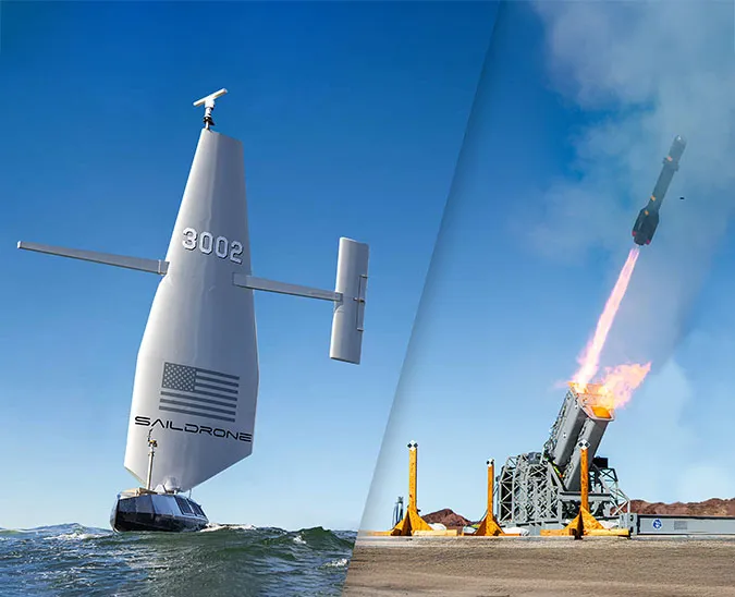
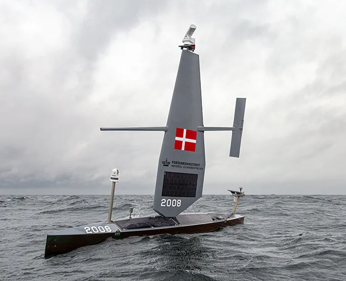
The 2018 Oil Detection mission in partnership with the National Oceanic and Atmospheric Administration (NOAA), the US Coast Guard (USCG), and US Navy SOUTHCOM tested the Saildrone unmanned surface vehicle (USV) as a platform for detecting oil on the sea surface. SD 1028 was deployed from Saildrone HQ in Alameda, CA, transiting to the survey area off the coast of Santa Barbara. A Remote Optical Watcher (ROW) unit was mounted to the bow of the saildrone in addition to the standard sensor suite, which includes science-grade sensors to collect data above and below the sea surface.

The ROW sensor uses oil’s natural fluorescence to detect hydrocarbons on the surface of the water in real time and generates an alarm when detected pollution is higher than the prescribed threshold. SD 1028 was visibly covered in oil when it returned to Alameda at the end of the mission, but both the USV and the ROW were in excellent condition.
Traditional methods of detecting accidental oil discharges—satellites and manned overflights—are expensive and provide limited spatial and temporal coverage. The Landsat 8 satellite offers spatial resolution but passes over a specific point only once every 16 days (on average), and clouds or smoke can mask the area entirely. Synthetic aperture radar (SAR) satellites like the Sentinel can detect oil through clouds and smoke but are not available continuously. Manned overflights are weather dependent and costly.
-10.jpeg)
The Saildrone USV equipped with a ROW sensor is the first platform capable of long-range autonomous ocean oil detection missions, and it can be deployed on short notice to any location regardless of weather conditions. Saildrones are wind and solar-powered making them silent, clean, and non-disruptive the ocean environments they survey.
The goal of the 2018 mission was to demonstrate the capability of the Saildrone USV platform to detect the presence of oil and report its location. Satellite imagery provided by the NOAA NESDIS oil desk was used to validate the survey, showing that the ROW performed reliably throughout the mission successfully augmenting satellite detection.

When it comes to disaster mitigation, it’s not enough to know the location of the oil spill; it’s also necessary to know the direction the oil slick is traveling. In 2015, Saildrone and the ECOGIG consortium launched SD 125 in the Gulf of Mexico to locate natural oil seeps and study how environmental variables like wind speed and surface currents affect oil slicks. The mission showed that wind is largely responsible for the dispersal of oil slicks and currents dictate the size of the slick.
The Saildrone sensor suite includes a Gill Windmaster 3D ultrasonic anemometer installed at the top of the mast to provide accurate in situ data about wind conditions. An Acoustic Doppler Current Profiler (ADCP) sensor affixed to the keel continuously records three-dimensional data about the direction and strength of ocean currents. Saildrones are also equipped with cameras to capture visual documentation of oil on the sea surface.
A fleet of Saildrone USVs equipped with ROW sensors could provide an environmental baseline for regions where natural and manmade oil incidents often occur. Active monitoring could prevent new spills from developing into major catastrophes, and in the event of a major spill, saildrones could be rapidly deployed to provide high-resolution in situ data to help emergency responders onshore understand the complicated dynamics of the spill.
Resources
Accidental Discharges of Oil, Global Marine Pollution Information Gateway, accessed May 14, 2019
Gulf Oil Spill, Smithsonian Institution, The Ocean Portal Team, accessed May 14, 2019
Oil Tanker Spill Statistics 2018, International Tanker Owners Pollution Federation Limited (ITOPF), accessed May 14, 2019