Data collected by a fleet of Saildrone unmanned surface vehicles (USVs) will inform this year’s Alaska pollock fish stock assessment.
USVs Complete Milestone Alaska Fisheries Survey
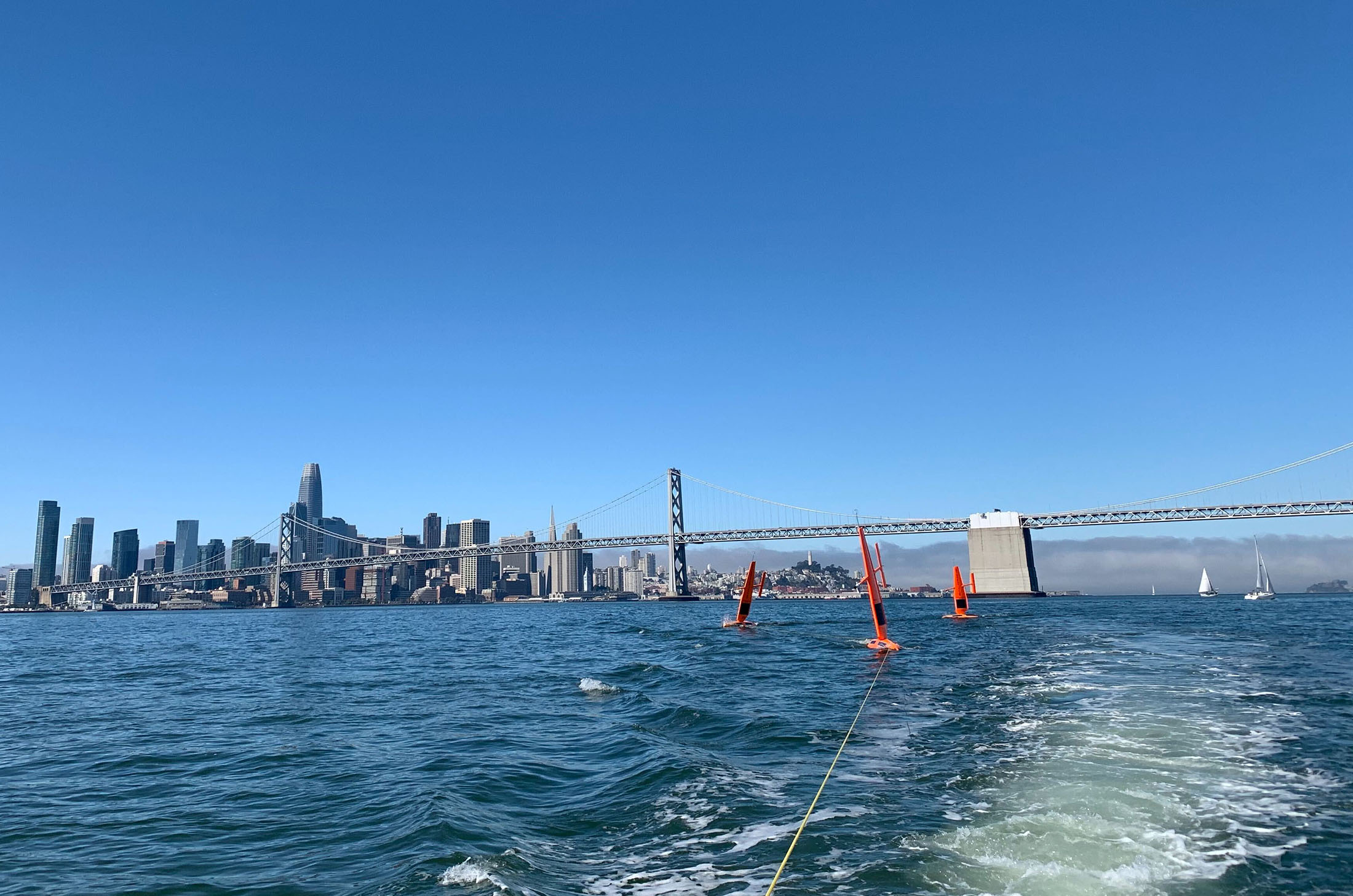
Three saildrones with the San Francisco skyline and the Bay Bridge in the background, recovered after sailing more than 6,000 nautical miles to the Bering Sea and back.
Published on
December 10, 2020
Read time:
5
Minutes
NOAA Fisheries’ Alaska Fisheries Science Center (AFSC) called on Saildrone to perform this year’s acoustic survey of Alaska pollock. Saildrone deployed three unmanned surface vehicles (USVs) for the 2,000 nautical mile transit from San Francisco to the Eastern Bering Sea just nine days after the last-minute contract was signed. The USVs were deployed in May, completed the survey in late July, and arrived back in San Francisco in early October to deliver the raw data after nearly five months at sea.
“The timing was critical. For the data to be actionable, we had to get it, process it, and incorporate the results into the stock assessment and present it to the Fisheries Management Council on a very short timeline,” said Alex De Robertis, a fisheries biologist at NOAA Fisheries and project lead for the Alaska Fisheries Science Center (AFSC). “Everything went as well as one could have possibly hoped for. The saildrones didn’t have any issues, the echo sounder didn’t have any issues, and all the data were there. It’s kind of amazing if you think about it. It was risky, but it all worked according to plan.”
The Alaska pollock fishery in the Eastern Bering Sea is the largest commercial fishery in the US by volume. Sustainable management of the fishery requires scientific, fisheries-independent surveys to set appropriate fishing quotas.

NOAA Fisheries traditionally uses research vessels and chartered fishing vessels to perform fisheries surveys, but this summer’s ship-based surveys in the region were canceled due to the COVID-19 pandemic. As a contingency plan, AFSC elected to use saildrones to perform the survey; the data collected is being used in the stock assessment, and also continues the existing time series.
“I think this is the first time that data from a USV are used in a formal stock assessment. This mission shows that Saildrone can do this operationally—reliably, quickly, and in the timeline required,” said De Robertis. “This wasn’t a demonstration of what we could do in the future. We did this now.”
Saildrone began working with NOAA Fisheries, NOAA’s Pacific Marine Environmental Laboratory, and Kongsberg in 2015, to develop methods of acoustic data collection and processing for its fleet of USVs. The Simrad EK80 echo sounder is the world-standard instrument for acoustic fisheries surveys on a variety of platforms, from research vessels to dedicated versions for marine vehicles and moorings. Saildrones carry a calibrated EK80 38/200 kHz echo sounder, as well as oceanographic and meteorological sensors to collect environmental data.
“Today’s EK80 is the result of continuous innovation, with the line of Simrad EKs dating back to the 1960s. The development has happened in close connection with leading marine institutes, and with the EK80 we introduced a wideband echo sounder that multiplies the amount of information we’re able to collect many times over—that’s what most research vessels have onboard today and that’s what we also see being utilized on the new scientific platforms. This is a proven and trusted instrument, and that’s important,” said Tonny Algrøy, sales director for underwater science at Kongsberg Maritime. “There is a lot of potential for what the Saildrone vehicle can do with this instrument.”

Saildrones have been shown to produce comparable pollock backscatter measurements to NOAA Fisheries research vessel Oscar Dyson (De Robertis et. al. 2019). This year’s survey was modeled after the planned Dyson survey, with some modifications: The saildrones surveyed along tracks spaced 40 nautical miles apart (Dyson tracks are typically spaced at 20 nm). The saildrones only surveyed during daylight hours, and the survey was paused if wind speeds were greater than 25 knots due to potential degradation of data.
“If you’re on a ship and something goes wrong, you can fix it. In this case, you’ve got to get it right the first time. We were able to do this quickly because of our previous experience. In a way, we’ve been working up to this mission for the past five years,” said de Robertis.
There are limitations to using saildrones instead of ships for the Alaska pollock survey: They are small, wind-powered vehicles, rather than diesel-powered ships, which means they have to tack in order to sail upwind. They also measure backscatter instead of biomass, and they can’t collect samples for species verification and age and size composition.
De Robertis explained that the Alaska pollock survey was feasible because fish backscatter on the Eastern Bering Sea shelf is dominated by Alaska pollock and there is a long history of surveys to draw from. Observations were averaged into “straight” transect segments according to spatially averaged bins, and backscatter was converted to biomass with a reasonable amount of uncertainty. The data was processed in a similar way to traditional acoustic-trawl survey data.
“This project was focused on one single goal, and that was getting an estimate of pollock abundance to be used for fisheries management. It boils down to two numbers: how many fish there are, and how confident we are. And that’s what we did,” he said.

The 2020 Alaska pollock survey is Saildrone’s seventh mission in the Arctic and first operational mission. Previous missions have studied the impacts of climate variability on northern fur seals, measured carbon dioxide and the abundance of Arctic cod, tracking Alaska red king crab, and collected observations for sea ice prediction and satellite algorithm development. Saildrone also performed its first single-beam mapping mission along Alaska’s North Slope this summer on behalf of NOAA’s Office of Coast Survey.
“This is a real transition from exploring what the saildrone can do to using these new tools to the best advantage, and a clear example of how information streams from USVs can be applied to fisheries management. Saildrone’s unique capabilities proved to be a valuable tool to provide information in a year where conventional surveys were not possible,” said De Robertis.
Read more: Environmental Changes in the Arctic Put Pressure on Fisheries Data Collection and Management
Must Read


[
NEVER MISS AN UPDATE
]
Stay informed with the latest research findings and updates.
By clicking Sign Up you're confirming that you agree with our Privacy Policy.
