Published on
Author
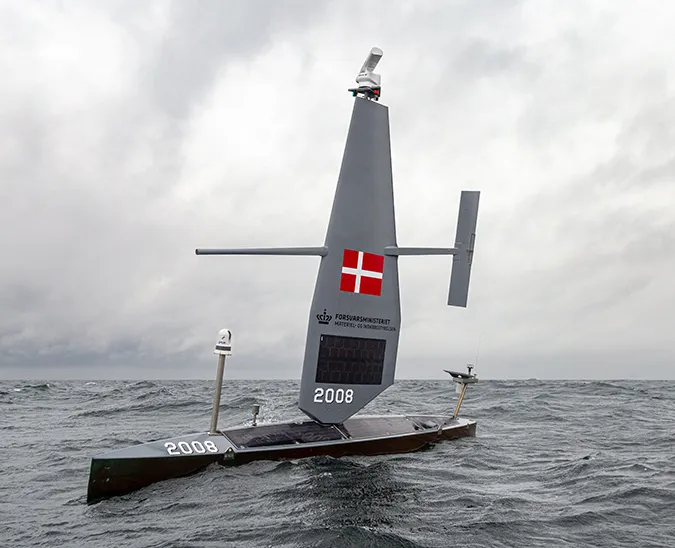
The 2019 Saildrone Antarctic Circumnavigation, the first autonomous circumnavigation of the Southern Ocean, endeavors to accomplish a significant list of science objectives, in collaboration with leading research agencies in the US, Europe, and Australia. The Southern Ocean accounts for approximately 40% of the total ocean carbon uptake, but only 20% of the surface area. Vast areas of the Southern Ocean remain unsampled, especially during the stormy autumn and winter seasons when ship-based observations are particularly difficult. Shifts in winds and circulation around Antarctica have already been shown to alter the amount of carbon dioxide uptake from the atmosphere. A full year of observations made with Saildrone unmanned surface vehicles (USVs) could provide critical data about how the region is changing, as well as the biological and physical processes driving those changes.
Scientists from the National Oceanic and Atmospheric Administration (NOAA) and Commonwealth Scientific and Industrial Research Organisation (CSIRO), among others, will use the data collected by Saildrone to study carbon uptake in the Southern Ocean.
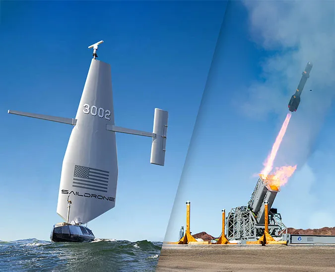
Wind and solar-powered saildrones are equipped with GPS and navigational instruments that make them capable of autonomously sailing a set course of waypoints, as prescribed by the Saildrone Mission Control in Alameda, CA. Saildrones are designed for deployment up to one year and return to port on their own. Minute level data is transmitted in real time; second per second data is downloaded upon mission completion.
“Over the past 20 years of making ship-based measurements, we’ve learned that there’s a lot more variability in the amount of carbon the Southern Ocean can take up than we’d previously realized. We need more information to understand the regional changes, and how carbon uptake is changing year to year, but we can’t get that with ships alone,” said Dr. Bronte Tilbrook, a biogeochemist studying ocean acidification and the global carbon cycle at CSIRO. “The advantage of the saildrones is that they can go to areas where there have been very few ship observations. We’re sending the saildrones into regions we just couldn’t before. It’s quite significant.”

Saildrone USVs carry a suite of science sensors to collect in situ data above and below the surface of the water including air and skin temperature, relative humidity, pressure, Chl-a, salinity, and pH. The ASVCO2 developed by NOAA allows us to measure the difference in the partial pressure of CO2 in the atmosphere and surface ocean, and this is used to calculate the amount of CO2 being absorbed or released by the surface ocean.
Over the course of the 270-day Antarctic mission, saildrones will periodically rendezvous with surfacing SOCCOM floats. SOCCOM floats are deployed from a ship and active for approximately three years. The saildrone will perform cross-validation sampling as close to the SOCCOM float as possible in terms of time and distance.
“The floats are suggesting that the wintertime conditions of CO2 uptake are changing quite a bit more than we understood. There’s an interesting set of data starting to emerge, showing that the overall Southern Ocean sink is more variable in the winter. The floats provide an opportunity to get some data, but we really need to verify it, and we can only do that by making independent measurements when they come up to the surface,” said Tilbrook.
Saildrones and SOCCOM floats present two very different sampling strategies: The saildrone is focused on air-sea interaction at the surface, and the float is focused on sub-surface measurements of the water column. The floats measure the pH of the water and infer the partial pressure of carbon dioxide. The ASVCO2 on the saildrone measures atmospheric CO2; an equilibrator pumps air through the surface of the seawater to bring the air and water into equilibrium in terms of CO2 for a short period of time.

“This mission is a preview of the kind of multi-platform, long-term observing system we could envision for the Southern Ocean. The SOCCOM floats have given us an unprecedented amount of data in this region, which challenged a lot of our assumptions about the ocean CO2 sink. But have conditions in this region the last few years been an anomaly, or not? Continuous, long-term observing is one way to find out,” said Dr. Adrienne Sutton, an oceanographer with the NOAA Pacific Marine Environmental Laboratory (PMEL) Carbon Group. The PMEL Carbon Group has been involved in all Saildrone missions related to CO2 to date.
The Saildrone Antarctic Circumnavigation is one of several ongoing and recent missions related to carbon uptake and data validation. On January 30, Saildrone launched a USV in Newport, RI, on a 30-day mission to study heat transfer and carbon flux in the Gulf Stream and in June 2018, the Saildrone Baja Campaign studied upwelling and frontal region dynamics, air-sea interactions, and diurnal warming effects along the US/Mexico coast to Guadalupe Island and assessed the Saildrone platform for satellite data accuracy and model assimilation.