Ocean Mapping
High-resolution Seafloor Intelligence Delivered Autonomously
Autonomous systems engineered for precise bathymetric mapping and environmental characterization—expanding access to the seafloor while reducing the cost, complexity, and risk of traditional survey operations.
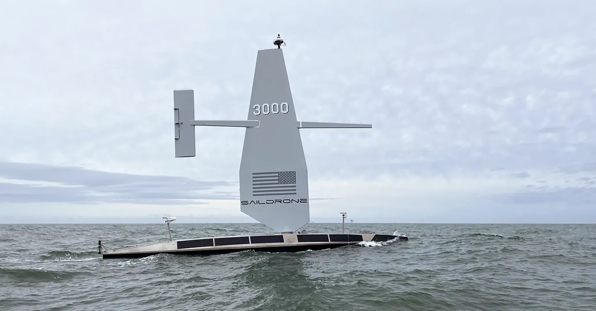
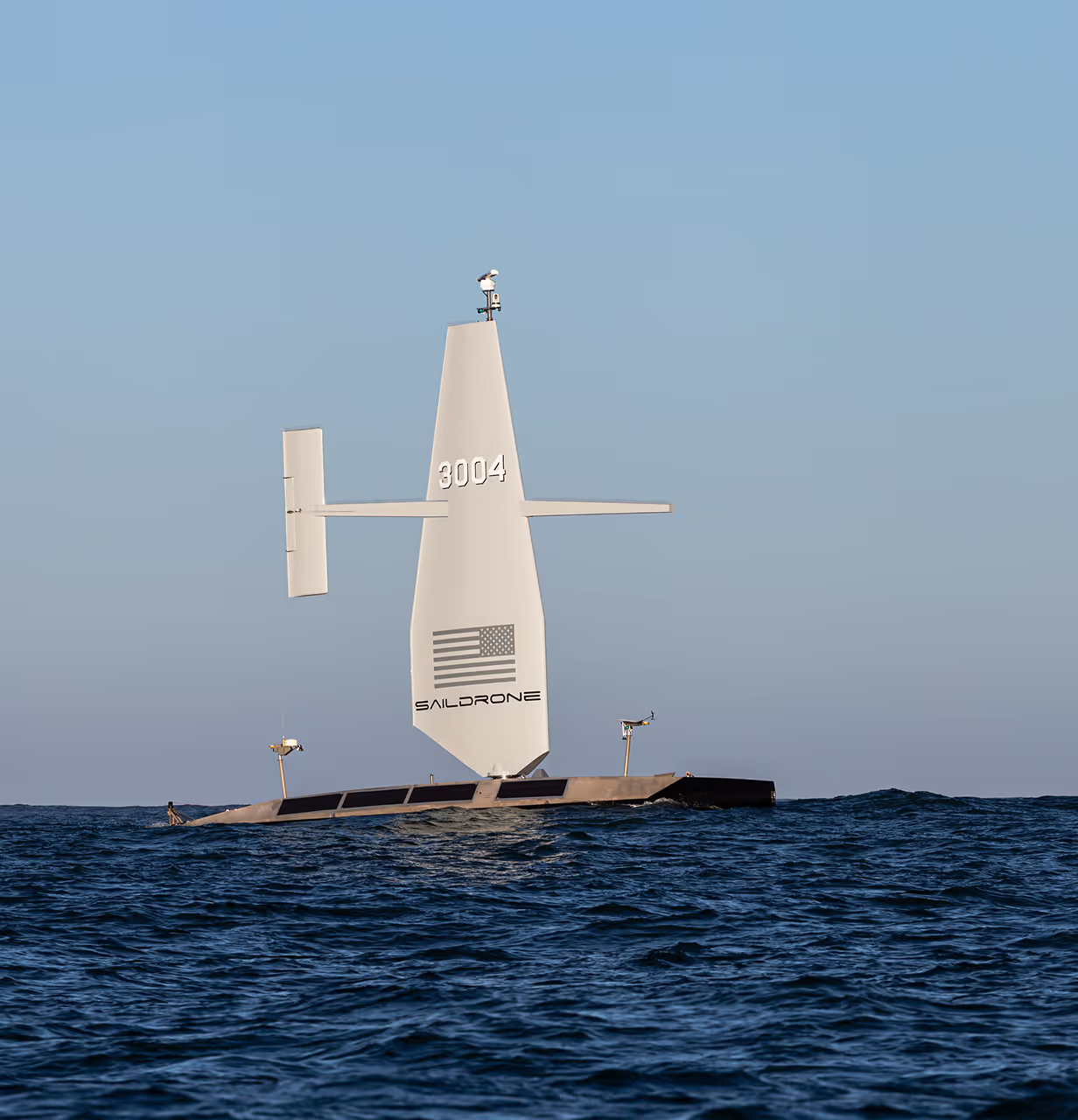
Saildrone delivers accurate, scalable ocean mapping using long-endurance unmanned surface vehicles equipped with professional-grade hydrographic sensor suites. By combining autonomous navigation, advanced multibeam systems, and continuous environmental measurements, Saildrone provides high-quality geospatial data across the world’s oceans—without the logistics burden or carbon impact of manned survey ships.
WHAT SAILDRONE DELIVERS
Mission-ready Solutions for High-fidelity Ocean Mapping
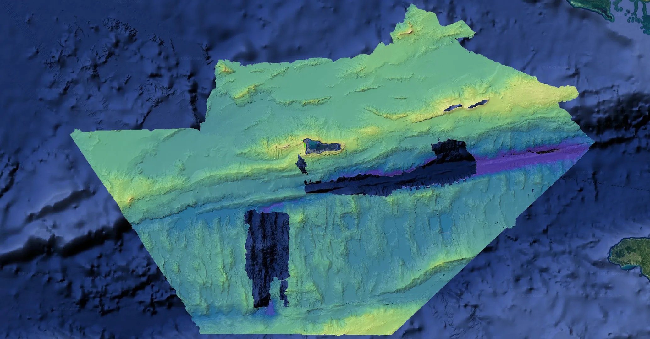
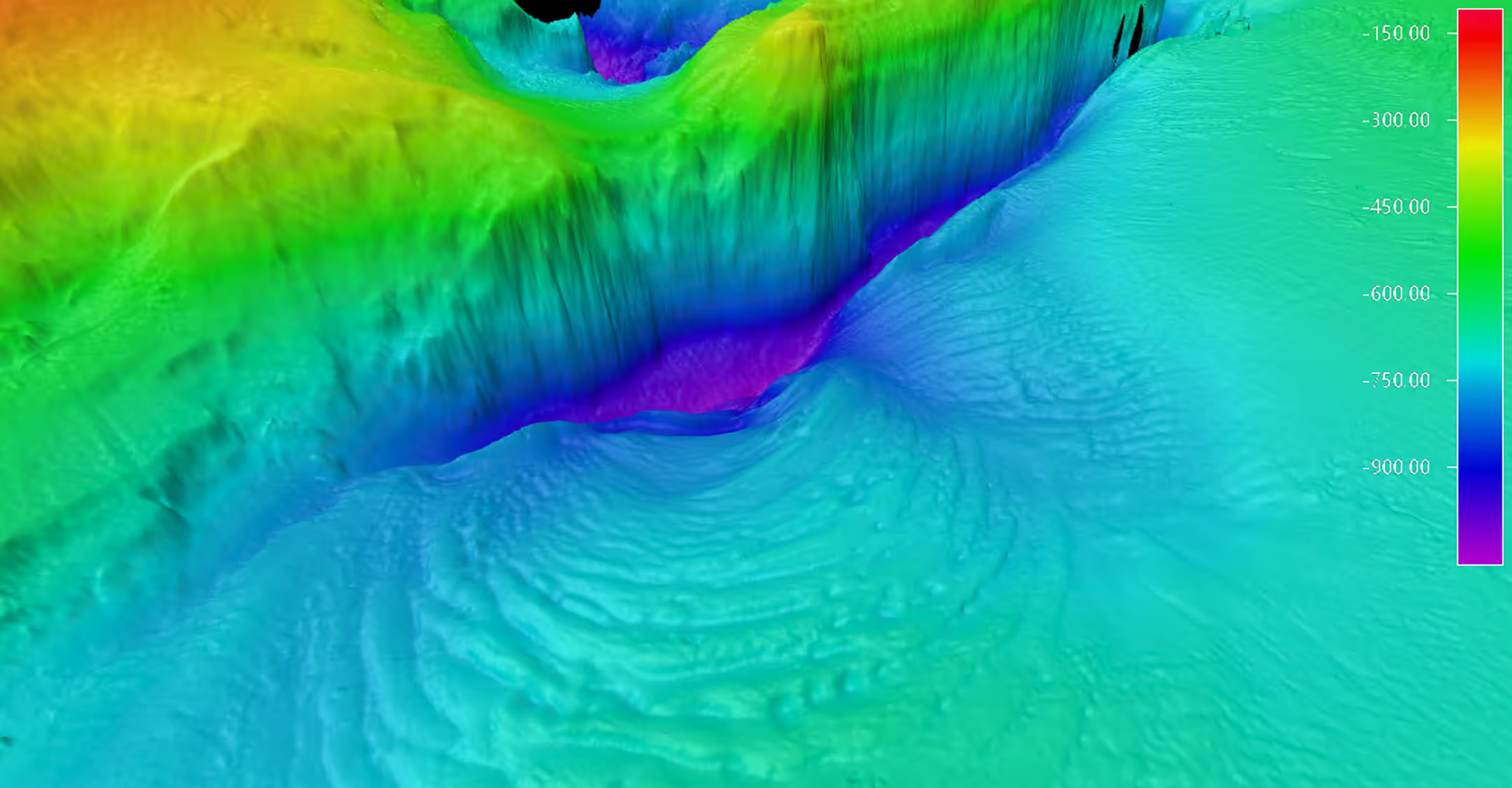
Saildrone provides high-resolution bathymetric mapping from nearshore to full ocean depths. Designed for persistence and data quality, these autonomous platforms operate continuously to deliver survey-grade results in remote or challenging environments.
- High-resolution multibeam bathymetry across coastal and deep-ocean regions
- Water-column backscatter and environmental measurements
- Autonomous survey patterns maintained without human engagement
- Wide-area coverage that accelerates large-scale mapping timelines
- Continuous, quality-controlled data flow for hydrographic and geospatial teams
SENSOR & DATA ARCHITECTURE
Integrated Hydrography for Accurate Seafloor Mapping
Saildrone USVs carry industry-standard hydrographic payloads combining deep-water and coastal multibeam systems, sound-velocity measurement, and precision navigation. These sensors operate continuously to acquire accurate, high-fidelity seafloor and water-column data.
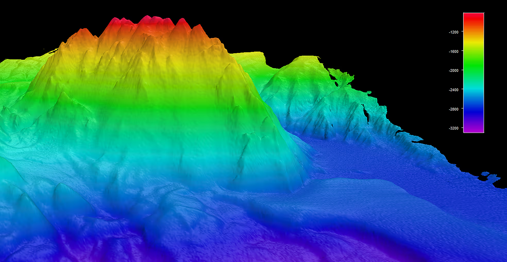
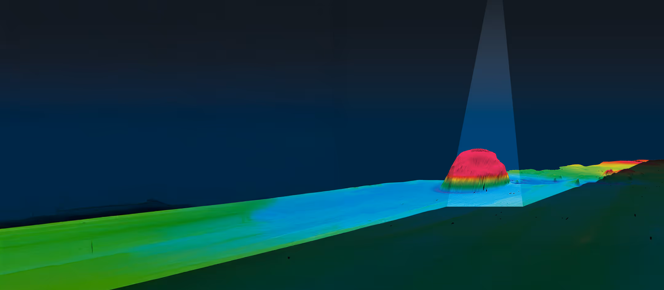
Multibeam Echosounder (MBES)
High-resolution bathymetry and water-column imaging using survey-standard sonar systems calibrated to meet international specifications.
Sound Velocity Measurement
Real-time sound speed profiles ensure accurate depth sounding in dynamic ocean conditions.
Positioning & Motion Reference
GNSS, inertial sensors, and motion compensation maintain data integrity in rough seas.
Environmental Measurements
Temperature, salinity, currents, and other oceanographic variables provide contextual environmental intelligence.
Data Delivery
Encrypted data transfer to the Saildrone Mission Portal or direct integration into your hydrographic or GIS workflow.
WHY SAILDRONE
Proven Performance from Nearshore to the Open Ocean
Endurance without refueling
The Saildrone Wing, in addition to augmenting propulsion systems, enables long-duration survey missions, reducing the logistical and carbon footprint of ocean mapping.
Superior platform stability
Hull designs optimized for deep-water multibeam acquisition maintain data quality in high sea states.
Access to remote environments
Autonomous operations extend survey reach into challenging or expensive-to-access areas.
Scalable coverage
Deploy vehicles individually or as coordinated fleets to accelerate regional or national mapping campaigns.
RECENT MISSIONS
Demonstrated Performance in Real-world Mapping Campaigns
Saildrone platforms have delivered deep-water surveys, coastal mapping, and environmental characterization missions globally—operating through extreme weather and remote zones without local support.