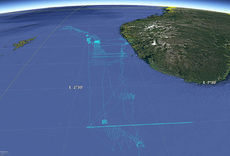
Two saildrones spent more than 200 days surveying sandeel, saithe, and herring off the coast of Bergen in partnership with Norway’s Institute of Marine Research.
Surveying Commercially Important Fish Stocks in the North Sea

Published on
February 20, 2020
Read time:
5
Minutes
Saildrone’s first mission in the North Sea, in partnership with Havforskningsinstituttet, Norway’s Institute of Marine Research (IMR), surveyed sandeel, North Sea saithe, and herring—three important species with significant commercial and ecological value. Two saildrones deployed from Bergen spent more than 200 days combined studying the temporal-spatial dynamic of fish aggregations and school formations in an exceedingly busy area of the North Sea.
The mission was a pilot study to evaluate the performance of the Saildrone platform in a region of dense marine traffic and also included comparison studies with the research vessel Eros.

The saildrones were equipped with Simrad EK80 scientific wideband echo sounders in addition to the standard Saildrone sensor package of oceanographic and atmospheric instruments.
“As an integrated sensor platform, the saildrone is very good. It records a large set of quite advanced sensor data with high quality. I have been in other surveys with commercial vessels or research vessels, and it’s hard to have all those sensors operating at a high level of quality at the same time. The Saildrone sensor package is a big advantage, and it allows us to see what kinds of factors can affect the biology and physical conditions in the sea,” said Espen Johnsen, IMR chief acoustician and principal investigator.
The lesser sandeel (Ammodytes marinus), also known as sand lance, is a primary source of nourishment for seabirds, especially puffins, as well as whales and dolphins within the North Sea ecosystem. There is also a significant commercial fishery, but the catch goes to fish meal and fish oil rather than to the fishmonger. Sandeel is a peculiar fish that spends most of its time buried in the sandy seabed.

“They don’t come out of the sand to eat every day, except in the spring, and that impacts the echo sounder measurement, resulting in an underestimate. It was important for us to be able to see how variable the abundance of sandeel was covering the same area several times,” explained Johnsen.
Sandeel and herring are both known to approach the surface at various times of the day if conditions allow, but large ships are not able to capture this behavior. They are disruptive, possibly causing fish avoidance, and they also have a significantly deeper draft than a saildrone—the Eros draws about eight meters (26 feet) compared the saildrone’s 1.8 meters (six feet)—which means that the echo sounder transducer is mounted deeper in the water on the RV than on the saildrone.
The echograms captured during the mission were consistent with those observed by other platforms, with one exception: They revealed schools of fish close to the surface, and in one, backscatter above the surface suggested diving seabirds. A search of the real-time images captured by the saildrone over the same time period revealed a flock of gannets diving for their dinner.
“We had high expectations for the echo sounder recordings, and we were not disappointed,” said Johnsen.

The relatively small and silent saildrones collect more than a dozen metrics, plus those of optional sensors, at a one-second resolution, or better. Research partners can access the data in real time and communicate with mission managers via the Saildrone Mission Portal.
“I was very impressed by Saildrone’s service. We got answers and responses almost immediately. It took no time at all to learn how to use the Mission Portal where you can see the data and input waypoints,” said Johnsen. “For the echo sounder, it’s very good to have in-house knowledge so that we could test out different settings.”
While the mission was defined well before the saildrones left the dock, the specific routes of the survey were not, rather, 24- to 48-hour legs were determined according to real-time observations made by Johnsen and his team on the Kristine Bonnevie.
“At least a few times, we changed the plan within a few hours based on what we observed in the water column from our research vessel, and it was very fast to make adjustments to the mission plan. We were communicating online, but it seemed almost like by phone,” Johnsen recalled.
The 2019 mission served as a proof-of-concept demonstrating the ability of the Saildrone platform to conduct long-term observations over multi-year missions in the North Sea and the Arctic Ocean.
Must Read


[
NEVER MISS AN UPDATE
]
Stay informed with the latest research findings and updates.
By clicking Sign Up you're confirming that you agree with our Privacy Policy.
