Published on
Author
Sustainable, effective long-term management of the Blue Economy requires regular and accurate measurements of essential ocean variables. The data required to enable this is scarce due to the collection barriers—the high cost and the logistical challenges of traditional methods such as research ships and buoys.
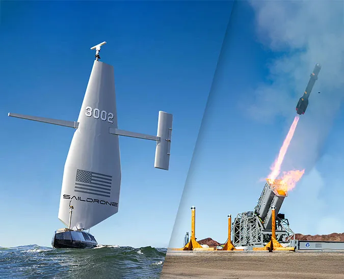
Saildrone’s uncrewed surface vehicle (USV) technology is designed to reduce these barriers, pushing technical and endurance boundaries, to collect critical ocean data where it has traditionally been out of reach, or prohibitively expensive to collect.
Saildrone (SD) 1079 has just completed a first-of-its-kind mission to remote areas of the equatorial Tropical Atlantic. Sailing 11,910 nautical miles (13, 796 miles or 22,057 km) and spending 370 days at sea, SD 1079 mission was to collect CO2 data to improve global carbon projections and help enable sustainable ocean resource management.
SD 1079’s voyage set a new Saildrone record for autonomous, uncrewed endurance, beating our previous record holder, SD 1020, by 31 nm. SD 1020 circumnavigated Antarctica in 2019, covering 11,879 nautical miles during that voyage.
The mission was conducted in a very biologically productive and nutrient-rich area of the ocean, but an incredibly difficult area for navigation, with extremely strong currents and light winds. This is an incredible testament to the endurance of the Saildrone Explorer class of vehicles.
“This has been a phenomenal mission,” said Richard Jenkins, Saildrone founder and CEO. “Not just by the range and endurance of SD 1079, but by the ability to take these crucial measurements in very remote parts of our oceans. Areas that are very hard to reach with traditional technologies like research ships.”
The EuroSea project, coordinated by GEOMAR Helmholtz Centre for Ocean Research Kiel, is a multi-national effort to enhance the European ocean observing and forecasting system. Two of EuroSea’s primary goals are to: 1) Deliver ocean observations and forecasts that will advance scientific knowledge about ocean climate, marine ecosystems, and their vulnerability to human impacts; and 2) demonstrate how the ocean is an essential part of an economically viable and healthy society—not only today but for decades to come.

Collecting carbon data where few sensors have gone before
Observations of air-sea carbon flux are essential to understanding carbon cycling and predicting future changes to Earth’s climate. The Global Carbon Budget uses ocean carbon uptake estimates generated by models and sophisticated statistical methods to fill gaps where in situ data is lacking. The models work, despite a scarcity of data, but they can’t yet reconstruct all the rich, spatial patterns in the dynamic ocean environment. However, there is a significant difference between model-based estimates and observation-based estimates, about 4 billion tons of CO2, which is as much as produced by the US annually. The Atlantic Ocean, especially in the tropical and equatorial regions, is an area of ocean where there are few meteorological and oceanographic measurements, let alone measurements of air-sea carbon exchange.
The PIRATA (Prediction and Research Moored Array in the Tropical Atlantic) network was established in the 1990s to study ocean-atmosphere interactions in the Tropical Atlantic that affect regional weather and climate variability on seasonal, interannual, and longer time scales. Ocean-atmosphere interactions in this region influence the development of droughts, floods, severe tropical storms, and hurricanes, with impacts felt by millions of people in the Americas and Africa. PIRATA includes some 19 active buoys, however, only two of them are currently equipped with CO2 sensors.
The sensors that do exist are a different type than that carried by Saildrone USVs, with higher uncertainty. And, the mobile saildrones offer a rare chance to perform important intercomparisons with fixed buoys, as well as with a few biogeochemical Argo floats that carry out carbon measurements in the region. With this demonstration mission, the EuroSea project works to improve both the number of carbon observations and the quality of these observations in the Tropical Atlantic.
SD 1079 is the first uncrewed vehicle to carry the Gen 2 ASVCO2 sensor, which was developed through a public-private partnership between the National Oceanic and Atmospheric Administration (NOAA)’s Pacific Marine Environmental Laboratory (PMEL) and Saildrone. This is the next generation of a high-accuracy sensor measuring partial pressure of carbon dioxide (pCO2), based on the MApCO2 technology originally developed by the Monterey Bay Aquarium Research Institute (MBARI) in the 1990s.
The technology behind these systems utilizes a World Meteorological Organization (WMO)-certified reference gas to ensure highly accurate readings over a long-duration mission, like this one. The data collected by SD 1079 will be useful to validate measurements from other platforms.

“Our main objective is to better quantify the air-sea gas exchange in the tropical Atlantic; this region is much more under-investigated with regard to carbon than some other areas of the ocean. The completed mission with its large number of carbon measurements in this remote study area off West Africa, plus the measurements from the transit times of the saildrone, has created a reference data set that allows us to validate the measurements from other assets on the water—the Argo floats and PIRATA buoys,” explained Björn Fiedler, a marine chemist at GEOMAR and principal investigator.
The two PIRATA buoys carrying CO2 sensors are located on the equator and just to the south of the equator. SD 1079 visited the buoy on the equator but was unable to reach the buoy to the south due to strong currents and light winds. “We saw some limitations in the performance of the vehicle as we got closer to the equator, and there are some things we learned to do differently next time, but overall, we are quite happy,” said Fiedler.
EuroSea is similar in purpose and objective to Saildrone’s 2019-2020 Atlantic to Mediterranean (ATL2MED) mission, which was led by the Integrated Carbon Observation System, Ocean Thematic Center (ICOS OTC) based in Bergen, Norway, along with GEOMAR. Both missions leverage the Saildrone USV as a moving reference platform for carbon measurements, connecting remote platforms with each other. “In fact, what we’ve done is extended the previous mission into the equatorial Atlantic, connecting even more remote points than the ones we targeted during ATL2MED,” said Fiedler. “Such missions are only possible when multilateral institutions and stakeholders from the region are acting together.”
Now that the vehicle has returned to shore, the high-resolution raw data will be quality controlled by NOAA PMEL. “Once we have the final data, we can finally start working on comparing the different carbon observations with each other and derive air-sea carbon fluxes,” said Fiedler.
Saildrone’s 2021-2022 EuroSea mission was led by GEOMAR Helmholtz Centre for Ocean Research Kiel, along with the Observatoire Océanologique de Villefranche-sur-Mer (LOV), Institut de recherche pour le développement (IRD), Euro-Argo RI, and Brazil’s Federal University of Pernambuco (UFPE) and Universidade do Estado do Rio de Janeiro (UERJ).
Under the FAIR data principles of making scientific data findable, accessibly, interoperable, and available for reuse, the data collected during Saildrone’s EuroSea mission will be available through the Copernicus Marine Service, EMODnet, and SeaDataNet portals.
To the equator and back, powered solely by the wind
Collecting ocean data using a wind-powered vehicle in the equatorial Atlantic, where light winds and strong currents are prevalent, poses inherent logistical challenges.
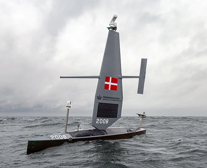
The Saildrone Explorer is a 23-foot wind and solar-powered uncrewed surface vehicle (USV) designed to collect high-resolution ocean data in remote areas of the ocean. Saildrone USVs are deployed and recovered from any oceanside dock and are designed to fit into a shipping container for transit to any launch site. Once launched, they can make their own way to the area of study, returning to port at the end of the mission, with a zero operational carbon footprint.
Last summer, when the mission began, ongoing travel restrictions due to COVID-19 created additional challenges: the Saildrone deployment team was unable to travel abroad. Instead of deploying the vehicle from Cabo Verde, off the west coast of Africa, as originally planned, SD 1079 was deployed from Newport, RI, on July 6, 2021, for a 3,100 nm transit across the North Atlantic, which added 2.5 months to the mission.
Shortly after leaving Rhode Island, SD 1079 encountered Tropical Storm Elsa and then spent several weeks battling light winds across the top of the Bermuda high until it was finally able to turn south with the prevailing winds.

“When I heard about the idea of letting the vehicle sail across the Atlantic, I was a little concerned, but it turned out to be a great opportunity to still carry out the mission right in the middle of the pandemic, and it performed well all the way to Cabo Verde,” said Fiedler.
The 120 days of research officially began on September 18. SD 1079 arrived in the vicinity of an Argo float where it collected comparative measurements and then sailed 85 nm toward Sao Vicente Island for a rendezvous with Fiedler’s team to perform coordinated sampling. Colleagues from the Ocean Science Centre Mindelo also sent a diver into the water to give the vehicle a bottom cleaning—the Tropical Atlantic is an extremely productive area of the ocean, making saildrones prone to marine growth—before SD 1079 sailed to João Valente Bank, a coral reef between the Cabo Verde islands of Boa Vista and Maio, for a hydroacoustic sub-survey period in shallower waters to determine the distribution of fish and zooplankton around the remote reef.
SD 1079 completed its data collection for the EuroSea project last February and began the more than 4,500 nm transit back to the US. On July 11, the vehicle was in excellent condition when it was recovered safely in Jacksonville, FL, after the 11,910-nautical mile journey.

SD 1079 now enters the “Saildrone Hall of Fame”, which includes the USVs who have completed the most audacious feats. In 2013, an early-generation prototype of the Saildrone Explorer completed the first wind-powered uncrewed crossing from San Francisco to Hawaii. In 2019, just days after SD 1020 completed the first autonomous circumnavigation of the Southern Ocean, SD 1021 set a speed record for an uncrewed vehicle across the Atlantic Ocean, completing the 3,402-nautical mile (6,301.59-kilometer) passage in just 68 days. Two months later, it returned to Rhode Island, to become the first uncrewed vehicle to sail across the Atlantic in both directions. And in 2021, SD 1045 became the first uncrewed vehicle to sail through a category 4 hurricane, collecting high-resolution video and critical data from inside the storm.
Saildrone’s EuroSea mission and data collection, “SAILDRONE – Bestimmung regionaler Ozean-Atmosphäre-Gasaustauschflüsse im tropischen Atlantik,” is funded by the German Federal Ministry of Education and Research (FKZ:03F0885AL1). The EuroSea project has received funding from the European Union’s Horizon 2020 research and innovation programme under grant agreement No. 862626.
Resources
GEOMAR Helmholtz Centre for Ocean Research Kiel, “Maiden Voyage Tracking Carbon Dioxide in the Ocean,” press release, January 10, 2021