Published on
Author
The US Geological Survey is using two Saildrone Explorers on the Great Lakes from mid-July through September 2023 to improve fishery surveys in cooperation with several public, private, and non-profit partners in both the US and Canada. The experiments using Saildrone uncrewed surface vehicles (USVs) and other advanced technologies are just one part of a multi-year effort by USGS and fishery management partners across the Great Lakes to improve fishery science in support of the $7 billion Great Lakes fishery.
Fisheries or acoustic surveys on the Great Lakes are traditionally conducted using conventional, diesel-powered research vessels, which are relatively loud and, as a result, may impact data collected near the water surface when fish are scared away from the noise.
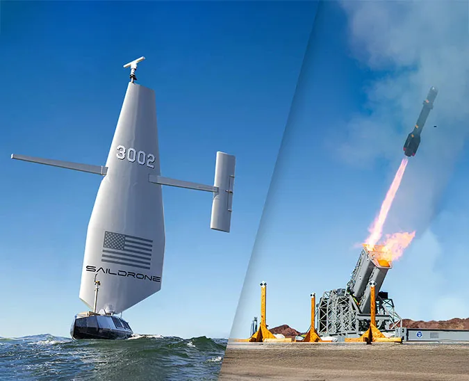
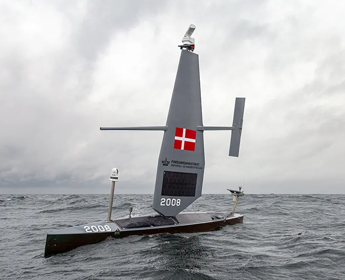
A Saildrone Explorer is Saildrone’s smallest class of USV, designed for long-range, autonomous maritime data collection. Saildrone Explorers are 7 meters (23 feet) long and use only wind power for propulsion. Solar energy powers the vehicle’s sensors and navigation systems. Saildrone Explorers are virtually silent in the water and unlikely to scatter fish.
%2520750px.jpeg)
“Technologies like Saildrone are helping us to more accurately monitor fish abundances, which gives the states and tribes better information to help manage the Great Lakes fishery,” said Dr. Peter Esselman, a USGS fishery biologist. “The great advantage of a wind-powered drone is that it can stay on the water collecting data 24 hours a day for months at a time, greatly expanding the amount of water we can monitor for fish. The [saildrone] moves slowly and is not dangerous, but we encourage boaters to maintain safe distances from the [vehicle] to ensure a successful mission.”
In July, Saildrone Explorers were deployed from Erie, PA, and Charlevoix, MI. In addition to the standard suite of meteorological and oceanographic sensors, the vehicles also carry a fisheries echo sounder, which uses sound to detect fish, similar to a fish finder on a fishing boat.

The saildrones, along with a long-range autonomous underwater vehicle (LRAUV) operated by the Monterey Bay Aquarium Research Institute (MBARI), provide advantages for fishery research that may address potential bias in existing fisheries acoustic surveys. The LRAUV, which operates in the middle of the water column, has echo sounders looking up and down, allowing it to detect fishes near the bottom and surface that can’t be detected by either traditional acoustic research vessels or the saildrone. Scientists will compare the data gathered using the saildrones and research vessels to address potential sampling biases in existing surveys.
After two weeks of on-the-water instrument calibration and transit to the start of the operational areas, the multi-agency mission began on August 1. The Lake Erie vehicle began data collection offshore of the USGS research station in Huron, OH, and the Lake Michigan/Huron vehicle began data collection began west of the Fox Islands in Lake Michigan.
Similar experiments took place in lakes Michigan and Huron in 2021 and Lake Superior in 2022, but this is Saildrone’s first year working on Lake Erie.
“This is the first time a highly visible long-range wind-powered autonomous surface vehicle will be used on Lake Erie,” said Dr. Mark DuFour, a USGS fishery biologist. “USGS is looking forward to working closely with Lake Erie partners to inform management of relevant questions important to stakeholders.”
The saildrone operating in Lake Erie will traverse the western, central, and eastern basins, circumnavigating the lake in a clockwise direction through the end of September.

“Lake Erie is home to a world-class fishery and millions of lakeside residents and vacationers," said David Nihart, Fisheries Management Chief for the Pennsylvania Fish and Boat Commission and Chair of the Lake Erie Committee, which consists of senior fisheries managers on the lake and is organized under the Great Lakes Fishery Commission. “Monitoring Lake Erie fish populations is integral to sustainable management of the recreational and commercial Lake Erie fishery, but fish community changes and dynamic habitat conditions often create monitoring challenges. We are excited to collaborate with the USGS to explore the use of autonomous vehicles for monitoring Lake Erie fish populations and fisheries.”
Partners on these studies include the Michigan Department of Natural Resources, the Wisconsin Department of Natural Resources, and the Ontario Ministry of Natural Resources and Forestry.
“These experiments using advanced technologies and autonomous vehicles are just one part of a multi-year effort by USGS and fishery management partners across the Great Lakes,” said Commissioner Jim McKane, chair of the Great Lakes Fishery Commission. “This is what 21s-century science looks like, and it’s happening now here in the Great Lakes thanks to strong collaborative partnerships.”
The Saildrone Explorers will also be used to study a variety of other fishery-related questions on Lake Erie. In the western basin, scientists from USGS, the Ohio Department of Natural Resources, the Michigan Department of Natural Resources, and The Ohio State University are studying the effect of harmful algal blooms on yellow perch, which support popular recreational and commercial fisheries
In the eastern basin, scientists from USGS, the New York State Department of Environmental Conservation, the Ontario Ministry of Natural Resources and Forestry, and the Pennsylvania Fish and Boat Commission are studying how data provided by Saildrone about the presence of large species (such as lake whitefish, burbot, and lake trout) corresponds to data gathered during the annual interagency bottom-set gill net survey.
And in the central basin, scientists from USGS and the Ohio DNR will explore the effect of low-oxygen zones (also known as hypoxic zones or dead zones) on bottom-dwelling fish.
“Saildrone provides cost-effective and environmentally friendly oceanographic data collection to scientists working to protect and understand Earth’s oceans and lakes. With two years of successful data collection missions in lakes Michigan, Huron, and Superior, Saildrone is proud to continue to support USGS’s data needs this year in lakes Michigan, Huron, and Erie,” said Matt Womble, Sr. Director of Ocean Data Programs at Saildrone.
Saildrone is continuing a multi-year fisheries study with the National Oceanic and Atmospheric Administration’s Southwest Fisheries Science Center along the US West Coast and has previously conducted similar surveys in the Arctic and North Sea. In 2020, when research vessels could not operate due to the COVID-19 emergency, three saildrones were deployed from company headquarters in Alameda, CA, to sail to the Bering Sea to conduct a three-month survey of Alaska pollack. The mission was heralded as an example of how using autonomous platforms like the Saildrone Explorer, artificial intelligence, and telepresence can support ocean science objectives and how they are transforming future ship design.
Resources
Heather Bricca, “Saildrone's Quiet Voyage: Autonomous Vessel Aids Great Lakes Fish Stock Study,” upnorthlive.com, August 1, 2023
Lester Graham, “Research Vessels Are on the Great Lakes, But There's No Crew On Board,” michiganradio.org, July 20, 2023
US Geological Survey, “USGS And Partners Deploy Autonomous Surface and Underwater Vehicles on Lake Erie to Improve Annual Fishery Assessments,” press release, usgs.gov, July 16, 2023
US Geological Survey, “USGS And Partners Deploy Autonomous Vehicles on Lakes Michigan and Huron to Improve Fishery Assessments,” press release, usgs.gov, July 20, 2023