Published on
Author
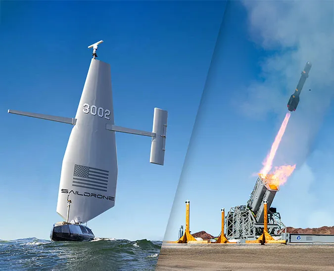
Hurricane track and intensity forecasting has steadily improved in recent years with data from satellites, buoys, and sensors dropped from aircraft flown into the developing storm. But scientists say there is still a big gap in our understanding of the rapid intensification of tropical cyclones and the ocean-atmosphere interactions that provide them energy. What’s needed is a way to make direct and simultaneous ocean and atmospheric measurements inside a storm. Earlier this week, Saildrone deployed an uncrewed surface vehicle (USV) equipped with a wing designed to withstand a hurricane.
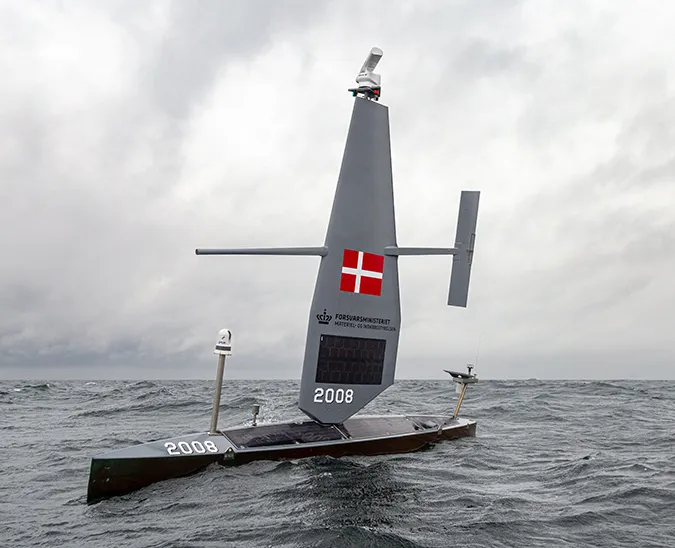
SD 1054’s “storm wing” will be tested for four months in the North Pacific in an area of ocean known for intense winds and high seas. The mission is operated in partnership with the National Oceanic and Atmospheric Administration (NOAA)’s Pacific Marine Environmental Laboratory (PMEL) and Atlantic Oceanographic and Meteorological Laboratory (AOML).
A cyclone is a generic term for a rapidly rotating storm with a low pressure center and clouds spiraling toward the center of the system. Storms that originate in the tropics are called tropical cyclones; they are also known as hurricanes in the Atlantic and typhoons in the Pacific. The 2020-2021 Pacific Storm Test will take place some 200 nautical miles (370 kilometers) off the coast of Oregon and Washington, and possibly as far north as the Gulf of Alaska, where winter storm wind speeds can reach Category 1 (64–82 knots/118–151 km/h) on the Saffir-Simpson Hurricane Wind Scale.
A new tool to fill the data gaps
The standard configuration of the 23-footSaildrone Explorer includes a rigid wing that is 15 feet (5 meters) tall. The wing has been optimized for light to moderately heavy wind conditions and has been consistently successful for missions in the Arctic, North Atlantic, Coastal Pacific, and Tropical Pacific regions. However, this tall wing has been damaged in extreme weather conditions like those of the Southern Ocean and the Gulf Stream.
During the 2019 Antarctic Circumnavigation, SD 1020 was equipped with a square wing designed to deal with the huge forces of being rolled and submerged by 50-foot (15-meter) breaking waves. Though the square wing worked well in the Southern Ocean, it does not allow the vehicle to sail upwind, therefore limiting its usefulness in other ocean regions. The compact design of the storm wing is optimized for all points of sail during extreme high-wind events.

“The primary objective of this test is to see how the new wing functions in hurricane-strength conditions. While the storms in the tropics are typically stronger, the storms in the North Pacific are more frequent and the season lasts longer, from November to March, which makes the North Pacific an ideal location for this first hurricane pilot project,” said Chidong Zhang, the Ocean Climate Research Division Leader at NOAA/PMEL.
Besides testing the new Saildrone storm wing and examining how close the saildrone will be able to approach the storms and how quickly, the USV will gather data about air-sea interactions during winter storm conditions. The mission will also include coordinated sampling with sea gliders operated by Oregon State University to combine atmosphere, surface, and sub-surface conditions from the saildrone with sub-surface ocean conditions provided by the gliders.
Sampling in the eye of the storm
The biggest challenge to hurricane forecasting is rapid intensification, which can have a huge impact if a storm intensifies just before landfall, but in order to do that, scientists need to understand the ocean processes that are occurring as intensity increases.
“Air-sea heat and moisture fluxes provide energy for a hurricane to develop—the fluxes are related to changes in hurricane intensity. We need to understand how much energy the ocean can provide to a storm. The fluxes, salinity, waves, sea spray, and other air-sea processes are important for the hurricane models. We hope that we’ll be able to use observations from saildrones to improve the model physics, and therefore, improve forecasts of hurricane intensity,” explained Jun Zhang, a scientist in the Hurricane Research Division at NOAA/AOML.
Saildrones have been shown to be an important new tool in the Global Ocean Observation System (GOOS), which includes research vessels, floats, buoys, subsurface vehicles, satellites, and aircraft-deployed probes. Equipped with a suite of atmospheric and oceanographic sensors, they collect data at the air-sea interface.
“The hurricane hunter airplanes hunt storms and deploy instruments that measure ocean and atmospheric parameters, but very often higher in the atmosphere. The saildrones continuously measure the atmospheric parameters at the sea surface. Together with ocean gliders, they are like sentinels; they observe the ocean and atmosphere in areas that we know hurricanes travel and intensify or weaken. These are two different strategies, and both are effective,” said Gustavo Goni, director of the Physical Oceanography Division at NOAA/AOML.
Goni noted that improvements in hurricane intensity forecasts are directly associated with an economic impact, as well as a reduction in the loss of property and life. But equally important, is to continue creating public trust in improved forecasts.
Global data collaboration
The data collected this winter will be sent to the World Meteorological Organization (WMO)’s Global Telecommunication System (GTS) in near real time and disseminated to all of the major forecast centers—some 20 agencies worldwide, including NOAA.
“It is expected that with this data on the GTS, after we verify it and show that the saildrone performs well in a hurricane environment, forecasters at the National Hurricane Center will use it as a qualitative check on the models’ current and predicted fields,” said Greg Foltz, an oceanographer in the Physical Oceanography Division at NOAA/AOML.
The test is planned to continue through February, with scientists from PMEL and AOML working together to pilot the saildrones and underwater gliders into a series of winter storms for testing of coordinated sampling of both vehicle types, as well as collect data near various buoys for data comparison. If the test is successful, the potential next step would be to conduct a pilot project in the Tropical Atlantic in summer 2021. A small fleet of saildrones would be stationed in areas of the western Tropical Atlantic, Caribbean, and the Gulf of Mexico that are known to experience hurricanes.
“These measurements from saildrones will be unique because, if all goes well, we’ll be able to measure the air-sea interface continuously through the middle of a hurricane, and this may be a key to understanding the process of rapid intensification,” said Foltz.
An ideal use of robotics
Saildrones are wind and solar-powered vehicles that can be deployed and retrieved from any ocean-side dock. Once deployed, they operate autonomously according to waypoints set by mission managers. Earlier this year, a fleet of saildrones deployed from San Francisco transited 2,000 nautical miles to the Bering Sea where three vehicles completed a 60-day acoustic survey of Alaska pollock. Four other vehicles continued through the Bering Strait to the North Slope of Alaska where they spent several weeks mapping the Arctic seafloor.
“This project is an ideal use of robotics. We’re working to improve our forecast systems, which is beneficial to everyone, without putting any humans into harm’s way. This is the latest iteration in the work we’ve done with Saildrone, from the high Arctic, where we were last year, to the Antarctic circumnavigation, with several tropical missions in between, and now we’re launching a mission to send a saildrone into winter storms and possibly develop one that can sample and survive inside a hurricane. These are incredibly difficult problems that we’re trying to solve together,” said Christian Meinig, Director of Engineering at PMEL.