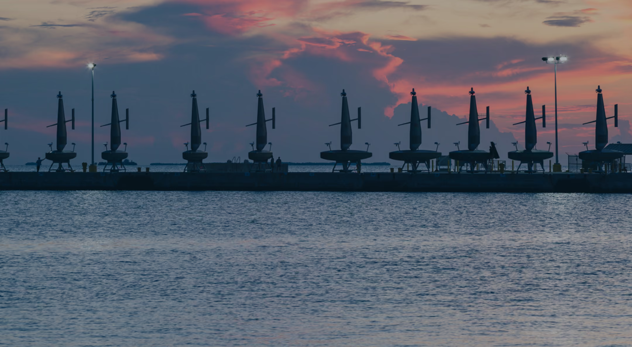
A $10 million NAVOCEANO task order calls for Saildrone Surveyor USVs to conduct bathymetric surveys in the Atlantic.
Saildrone Expands Ocean Mapping Work to US Navy Operations
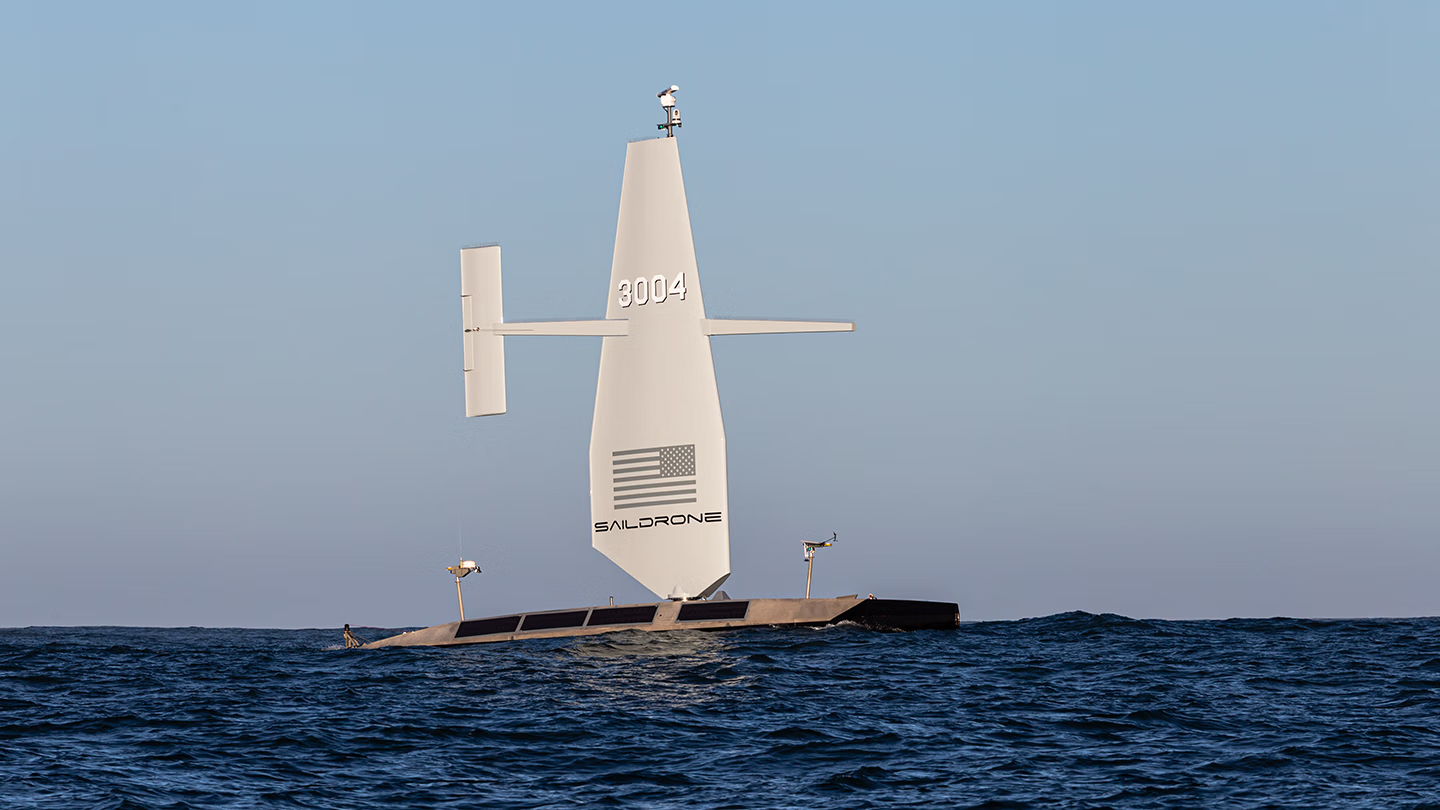
The 20-meter (65-foot) Saildrone Surveyor is a long-endurance, multimission unmanned surface vehicle equipped with deep-ocean multibeam sonar for high-resolution bathymetric mapping.
Published on
September 15, 2026
Read time:
5
Minutes
Beneath the ocean lies a complex landscape of mountains, canyons, ridges, and trenches. For naval forces operating on and beneath the surface, understanding the maritime terrain is essential, as gaps in that knowledge carry direct operational consequences.
Accurate bathymetry, the measurement of seafloor depth and shape, provides high-resolution imagery needed to safely plan and execute missions across the maritime domain. Yet most of the seafloor remains unmapped, leaving vast stretches of uncharted ocean and increasing the risk to operational forces.
The US Navy provides the Department of War with oceanographic, hydrographic, and bathymetric products to support safe navigation and mission planning. But building a more complete picture of the seafloor is an enormous undertaking. Long-endurance unmanned surface vehicles can augment the Navy’s traditional survey ships, collecting high-quality data across large areas and freeing Navy survey ships and crews to focus on areas that demand the hands-on expertise of the Navy’s oceanographic and bathymetric specialists.
The new US Navy contract awarded to Saildrone by the Naval Oceanographic Office (NAVOCEANO) reflects that objective, tasking the company with conducting bathymetric surveys in the Atlantic.
The contract is a $10 million task order for operations in the Atlantic. Survey operations are scheduled to begin in 2026 and continue through most of 2027 using Saildrone Surveyor USVs.
A key capability for operational safety and success
Only 28.7%* of the world’s oceans are mapped to modern standards, meaning the measurements yielded meaningful details about the seafloor’s shape and features. Much of the remainder is known only through lower-resolution estimates of the terrain. Closing those knowledge gaps with high-resolution seafloor imagery appears to remain a priority. Accurate bathymetry supports the safe navigation of manned vessels, enhances operational security in contested environments, safeguards critical infrastructure, and strengthens anti-submarine warfare and submarine operations by accounting for how seafloor terrain affects acoustic propagation and maneuvering.
“High-resolution ocean mapping is vital to the US Navy’s maritime superiority and strategic advantage, enabling safe navigation, effective submarine operations, and fleet lethality,” said Saildrone Sr. Dir. Ocean Mapping Kitch Kennedy, USN Capt. (ret.).
Allisions, when a moving vessel strikes a stationary object, with uncharted seamounts pose a serious threat to the safe navigation of operational Navy submarines. These events can result in the loss of human life, costly repairs to the submarine, and even the loss of the vessel itself. Seafloor bathymetry is critical for updating navigation charts, helping commanders safely navigate these obstacles, and serving as a reliable guidepost, providing a critical layer to the Navy’s assured position, navigation, and timing (PNT) capabilities.
Saildrone Surveyor USVs collect more than bathymetry. The platform also measures ocean currents down to approximately 1,000 meters (3,280 feet). Those observations add another layer of environmental information that can support naval operations and search-and-recovery efforts. If an aircraft goes down or a person is lost overboard, understanding how water moves at different depths can help predict where people or objects may drift.
Expanding ocean mapping capability
Saildrone began integrating bathymetric mapping systems in 2019, when a Saildrone Explorer equipped with a shallow-water multibeam echo sounder completed a demonstration in the Gulf of America in partnership with the University of Southern Mississippi and NOAA. The mission tested whether an unmanned surface vehicle could maintain the precise survey lines and power requirements needed for continuous multibeam operations, while collecting data that met or exceeded International Hydrographic Organization standards for safety-of-navigation surveys.
In 2020, Saildrone expanded that work into the Arctic, where four Explorers collected single-beam bathymetry to support NOAA efforts to improve nautical charts of the Bering Sea and Alaska’s North Slope.
Since those early missions, Saildrone’s ocean mapping capability has expanded from shallow-water and single-beam surveys to deep-ocean multibeam operations using the 20-meter Saildrone Surveyor USV.
Equipped with deep-ocean multibeam sonar, the 20-meter (65-foot) Surveyor collects high-resolution bathymetric data in remote ocean areas and supports persistent maritime intelligence, surveillance, and reconnaissance (ISR).
That combination of endurance and survey capability allows unmanned systems to complement the Navy’s existing oceanographic fleet. Rather than replacing crewed survey ships, platforms such as the Saildrone Surveyor can increase the amount of ocean that can be surveyed simultaneously, taking on persistent missions across remote areas where the time and cost of maintaining a crewed ship are significant.
“This contract to survey vast regions of the Atlantic Ocean, where traditional survey deployments are long and the conditions are unpredictable, is precisely the type of mission that Saildrone’s autonomous technology was designed to execute,” said Kennedy.
*According to the April 2026 release by the General Bathymetric Chart of the Oceans (GEBCO) Grid.


[
NEVER MISS AN UPDATE
]
Stay informed with the latest research findings and updates.
By clicking Sign Up you're confirming that you agree with our Privacy Policy.