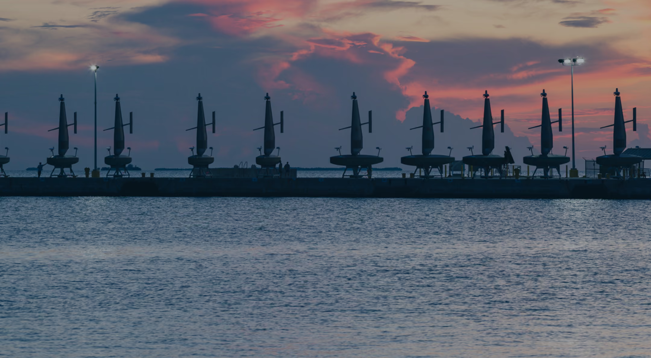
Led by researchers at NOAA and Columbia University, the Constraining Ocean Carbon with Optimized Observing (COCO2) project will use Saildrone USVs to reduce uncertainty in estimates of the ocean carbon sink.
Saildrone Embarks on a Multiyear Expedition to Monitor Carbon Exchange in the Southern Ocean
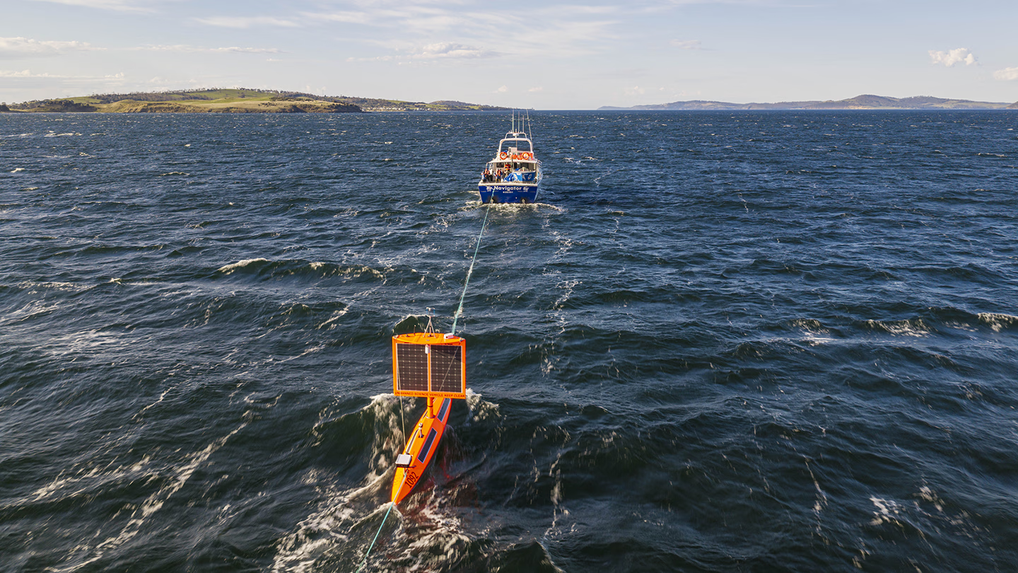
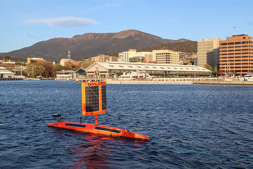
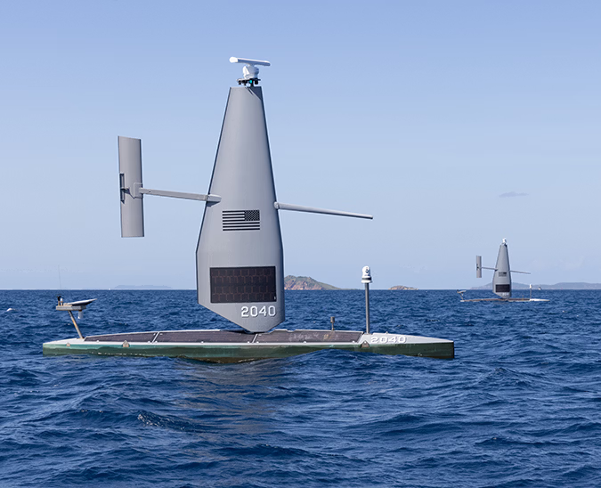
Saildrone Explorer SD-1092 was deployed from Hobart, Australia, bound for the Southern Ocean and a months-long circumnavigation of Antarctica. The USV is expected to return to Hobart in approximately 200 days. Photo: Fraser Johnston.
Published on
September 24, 2026
Read time:
5
Minutes
The Southern Ocean stands out among the world’s bodies of water. It connects the basins of every other major ocean, features unforgiving conditions that make transits difficult, and contains punishingly cold temperatures that drive a massive portion of the global ocean carbon sink, which absorbs about 30% of human carbon emissions annually.
These harsh conditions make monitoring and understanding how the Southern Ocean regulates the global atmosphere both critically important and exceedingly challenging. Closing that knowledge gap interests not only US policymakers but also governments and research institutions globally.
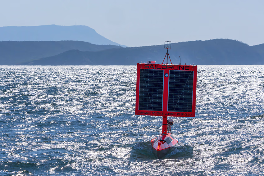
Led by researchers at the National Oceanic and Atmospheric Administration’s (NOAA) Pacific Marine Environmental Laboratory (PMEL) and Columbia University, the Constraining Ocean Carbon with Optimized Observing (COCO2) project is a five-year initiative that will deploy Saildrone unmanned surface vehicles (USVs) to implement a novel and scalable approach to observing air-sea carbon exchange and reducing data uncertainty in estimates of the global carbon sink. The first Saildrone Explorer USV was deployed from Hobart, Australia, on September 20, beginning a quarterly deployment cadence that will establish a fleet of four USVs operating around the Southern Ocean.
The Southern Ocean is one of the most difficult places on Earth to operate, which makes it exactly the kind of environment Saildrone was designed for. COCO2 puts that capability to work on an ambitious international mission, providing sustained access to a region that has historically been extremely difficult to observe.
The COCO2 collaboration brings together NOAA, Columbia University, the University of Washington, Australia’s national science agency CSIRO, the Australian Antarctic Program Partnership, South Africa’s Southern Ocean Carbon-Climate Observatory (SOCCO) and Council for Scientific and Industrial Research (CSIR), Schmidt Sciences through its Virtual Institute for the Carbon Cycle, and Saildrone.
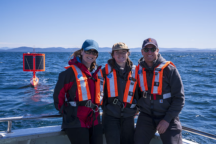
“The Southern Ocean is central to the uptake and storage of CO2 from human emissions,” said CSIRO’s Dr. Elizabeth Shadwick. “The Saildrone USVs are expected to travel over 24,000 nautical kilometres for each deployment, giving us unprecedented coverage of regions that we can’t get to with research vessels or commercial ships. This will help fill critical gaps on how much carbon is being absorbed by the Southern Ocean, and what influences it.”
Researchers at Columbia University’s Lamont-Doherty Earth Observatory will lead the project’s data analytics and observing planning, based on the expected impact of these data on gap-filled data products built with machine learning. They will identify high-uncertainty regions where filling data gaps will be most impactful, and adjust observing plans to direct USV transits across the Southern Ocean.
“We will be able to make adjustments over the course of the five-year mission to target data collection in the regions that are most needed to better understand the ocean carbon sink,” said Columbia University’s Professor Galen McKinley. “We will also apply advanced, model- and AI-observing tools to investigate carbon cycling in the Southern Ocean.”
South Africa’s Council for Scientific and Industrial Research (CSIR) provides critical observational capability and regional expertise.
“The Southern Ocean plays an important role in the global climate system,” said CSIR’s Dr. Sandy Thomalla. “Understanding the processes controlling CO2 uptake are central to having accurate projections of the Southern Ocean carbon sink in the future.”
Schmidt Sciences, which supports targeted climate research to advance understanding of global carbon uptake, provides philanthropic funding through its Virtual Institute for the Carbon Cycle.
A proven platform for hostile waters
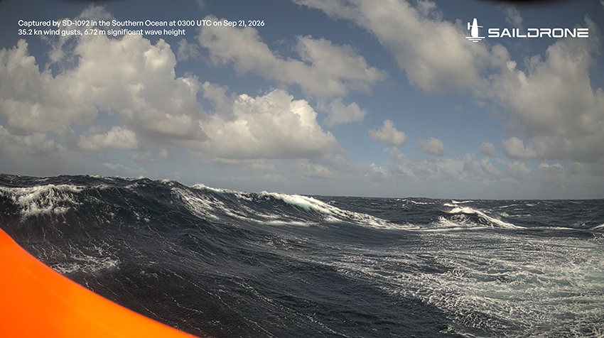
Compared to the Northern Hemisphere, the Southern Ocean is largely devoid of major landmasses, making it treacherous for crewed research vessels or unmanned surface vehicles to transit safely. This region presents extreme operational hazards, including drifting icebergs, hurricane-force winds that generate monstrous waves, and vast distances from shore-based infrastructure.
Historically, safely observing the Southern Ocean required chartering expensive research vessels, deploying large crews of mariners and scientists, and frequently losing valuable operational days to severe weather. What may be difficult conditions during favorable times of the year can become outright inhospitable during austral winter, so much so that research on the Southern Ocean often grinds to a halt.
The Saildrone Explorer USV provides a persistent, rugged platform that can survive the Southern Ocean’s extreme conditions, continuously monitor key carbon cycle metrics, and dynamically reposition to meet evolving operational needs. In 2019, Saildrone first proved its ability to operate effectively in the Southern Ocean when a Saildrone Explorer successfully circumnavigated Antarctica on a 196-day mission covering 11,879 nautical miles.
Saildrone’s 2019 circumnavigation of Antarctica proved that the Explorer could operate for months in some of the harshest conditions on the planet. COCO2 builds on that experience, moving from a single expedition to a repeatable operational model in the Southern Ocean.
COCO2 builds on the success of Saildrone’s 2019 mission by deploying multiple Saildrone Explorer USVs year-round to dynamically monitor air-sea CO2 exchange in regions where critical data gaps remain.
"The Southern Ocean is one of Earth’s harshest environments and notoriously difficult to observe. With today’s launch, we bring together new tools to overcome this challenge and tackle long-standing questions about the ocean's carbon sink,” said Dr. Adrienne Sutton of NOAA. “We will have a fleet of four Saildrone Explorers operating at different points around the Southern Ocean. As a USV completes a circumnavigation of Antarctica, it will come back into Hobart, where sensors will be replaced, and the USV will be redeployed to start another circumnavigation. This pattern will continue for the duration of the five-year project.”
.avif)
Evolution of the Saildrone wing
Following lessons learned during the 2019 mission, Saildrone focused on making the Explorer wing more robust for extended operations in demanding ocean conditions. The fundamental concept remains largely unchanged: a square-rig wing designed for downwind sailing, preserving the simple, proven configuration used on the earlier vehicle. The newer wing is heavier and more rugged, with updates aimed at improving durability, reliability, and overall system integration rather than changing the basic sailing approach.
The updated wing also incorporates new capabilities, including an integrated camera system for capturing both still images and video during missions.
These changes are part of a broader Explorer modernization project. The Explorer is Saildrone’s foundational platform and a proven workhorse for ocean science, with years of missions that have informed its evolution. The modernization effort refreshes the vehicle’s electronics, power, communications, sensor integration, and internal architecture while retaining the core platform and sailing characteristics proven over years of operation.
A scalable approach for closing the data gap
The Global Carbon Project (GCP) offers one of the most comprehensive views of the global carbon exchange between human emissions and absorption by land and sea. Data collected through COCO2 will feed directly into the Global Carbon Budget, which quantifies global emissions and natural sinks of anthropogenic CO2.
Ensuring that data is both accurate and comprehensive requires the scale and precision that is prohibitively expensive and impractical for crewed research vessels to accomplish alone. Saildrone provides one of the only unmanned surface vehicles capable of transiting the Southern Ocean year-round, monitoring key oceanic and atmospheric conditions, and dynamically adapting to environmental challenges in situ.
Resources
CSIRO, “Ocean Drones Set to Brave the Southern Ocean for Science,” press release, csiro.au/en, September 24, 2026
Constraining Ocean Carbon with Optimized Observing (COCO2), webpage, last accessed September 16, 2026
The Virtual Institute for the Carbon Cycle (VICC), webpage, last accessed September 16, 2026


[
NEVER MISS AN UPDATE
]
Stay informed with the latest research findings and updates.
By clicking Sign Up you're confirming that you agree with our Privacy Policy.